Marie | |
|---|---|
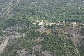 A distant view of the village of Marie | |
 Coat of arms | |
Location of Marie | |
 Marie 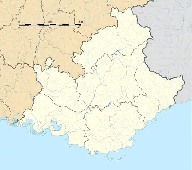 Marie | |
| Coordinates: 44°01′59″N 7°08′07″E / 44.0331°N 7.1353°E | |
| Country | France |
| Region | Provence-Alpes-Côte d'Azur |
| Department | Alpes-Maritimes |
| Arrondissement | Nice |
| Canton | Tourrette-Levens |
| Intercommunality | Métropole Nice Côte d'Azur |
| Government | |
| • Mayor (2020–2026) | Gérard Steppel[1] |
| Area 1 | 14.77 km2 (5.70 sq mi) |
| Population | 105 |
| • Density | 7.1/km2 (18/sq mi) |
| Demonym | Mariols |
| Time zone | UTC+01:00 (CET) |
| • Summer (DST) | UTC+02:00 (CEST) |
| INSEE/Postal code | 06080 /06420 |
| Elevation | 341–2,089 m (1,119–6,854 ft) (avg. 628 m or 2,060 ft) |
| 1 French Land Register data, which excludes lakes, ponds, glaciers > 1 km2 (0.386 sq mi or 247 acres) and river estuaries. | |
Marie (French pronunciation: [maʁi]; Occitan and Italian: Maria) is a commune in the Alpes-Maritimes department in southeastern France.
Population
| Year | Pop. | ±% |
|---|---|---|
| 1962 | 25 | — |
| 1968 | 50 | +100.0% |
| 1975 | 44 | −12.0% |
| 1982 | 50 | +13.6% |
| 1990 | 64 | +28.0% |
| 1999 | 50 | −21.9% |
| 2008 | 84 | +68.0% |
See also
References
- ↑ "Répertoire national des élus: les maires". data.gouv.fr, Plateforme ouverte des données publiques françaises (in French). 2 December 2020.
- ↑ "Populations légales 2020". The National Institute of Statistics and Economic Studies. 29 December 2022.
Wikimedia Commons has media related to Marie, Alpes-Maritimes.
This article is issued from Wikipedia. The text is licensed under Creative Commons - Attribution - Sharealike. Additional terms may apply for the media files.