Maresquel-Ecquemicourt | |
|---|---|
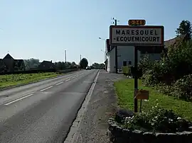 The road into Maresquel-Ecquemicourt | |
 Coat of arms | |
Location of Maresquel-Ecquemicourt | |
 Maresquel-Ecquemicourt 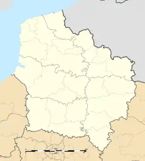 Maresquel-Ecquemicourt | |
| Coordinates: 50°24′40″N 1°55′41″E / 50.4111°N 1.9281°E | |
| Country | France |
| Region | Hauts-de-France |
| Department | Pas-de-Calais |
| Arrondissement | Montreuil |
| Canton | Auxi-le-Château |
| Intercommunality | CC des 7 Vallées |
| Government | |
| • Mayor (2020–2026) | Lionel Leborgne[1] |
| Area 1 | 7.89 km2 (3.05 sq mi) |
| Population | 1,038 |
| • Density | 130/km2 (340/sq mi) |
| Time zone | UTC+01:00 (CET) |
| • Summer (DST) | UTC+02:00 (CEST) |
| INSEE/Postal code | 62552 /62990 |
| Elevation | 13–104 m (43–341 ft) (avg. 26 m or 85 ft) |
| 1 French Land Register data, which excludes lakes, ponds, glaciers > 1 km2 (0.386 sq mi or 247 acres) and river estuaries. | |
Maresquel-Ecquemicourt is a commune in the Pas-de-Calais department in the Hauts-de-France region of France.[3]
Geography
Maresquel-Ecquemicourt is situated 8 miles (13 km) southeast of Montreuil-sur-Mer, on the D349 road.
Population
| Year | Pop. | ±% p.a. |
|---|---|---|
| 1968 | 934 | — |
| 1975 | 1,005 | +1.05% |
| 1982 | 1,037 | +0.45% |
| 1990 | 900 | −1.76% |
| 1999 | 847 | −0.67% |
| 2007 | 853 | +0.09% |
| 2012 | 913 | +1.37% |
| 2017 | 986 | +1.55% |
| Source: INSEE[4] | ||
Places of interest
- The church of Saint-Pierre, dating from the seventeenth century.
See also
References
- ↑ "Répertoire national des élus: les maires". data.gouv.fr, Plateforme ouverte des données publiques françaises (in French). 2 December 2020.
- ↑ "Populations légales 2020". The National Institute of Statistics and Economic Studies. 29 December 2022.
- ↑ INSEE commune file
- ↑ Population en historique depuis 1968, INSEE
Wikimedia Commons has media related to Maresquel-Ecquemicourt.
This article is issued from Wikipedia. The text is licensed under Creative Commons - Attribution - Sharealike. Additional terms may apply for the media files.