Marcella, Mississippi | |
|---|---|
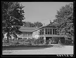 Jones family home in Marcella in October 1939 | |
 Marcella  Marcella | |
| Coordinates: 33°07′46″N 90°17′51″W / 33.12944°N 90.29750°W | |
| Country | United States |
| State | Mississippi |
| County | Holmes |
| Elevation | 115 ft (35 m) |
| Time zone | UTC-6 (Central (CST)) |
| • Summer (DST) | UTC-5 (CDT) |
| ZIP code | 39169 |
| Area code | 662 |
| GNIS feature ID | 673128[1] |
Marcella is an unincorporated community located in Holmes County, Mississippi near the Yazoo River. Marcella is located near Mississippi Highway 12 and is approximately 5 miles (8.0 km) north of Thornton, and approximately 9 miles (14 km) south of Tchula.
Marcella is named for the Marcella plantation.[2]
A post office operated under the name Marcella from 1881 to 1894.[3]
Marion Post Wolcott documented people and scenes from the Marcella plantation in October 1939 as part of her work with the Farm Security Administration.[4]
References
- ↑ U.S. Geological Survey Geographic Names Information System: Marcella, Mississippi
- ↑ William P. Hustwit (February 5, 2019). Integration Now: Alexander v. Holmes and the End of Jim Crow Education. Chapel Hill, North Carolina: University of North Carolina Press. p. 24. ISBN 978-1-4696-4856-9.
- ↑ "Holmes County". Jim Forte Postal History. Retrieved June 3, 2021.
- ↑ "Marcella Plantation". Library of Congress. Retrieved June 4, 2021.
Municipalities and communities of Holmes County, Mississippi, United States | ||
|---|---|---|
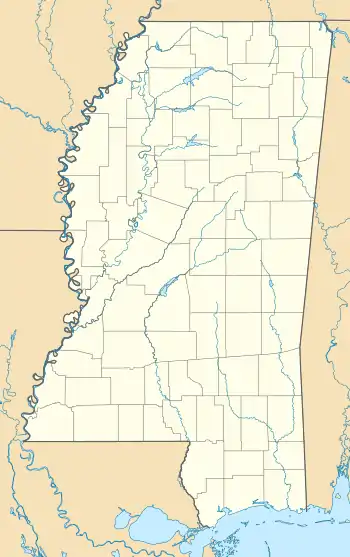
| Cities |  Map of Mississippi highlighting Holmes County | |
| Towns | ||
| Unincorporated communities | ||
| Ghost town | ||
This article is issued from Wikipedia. The text is licensed under Creative Commons - Attribution - Sharealike. Additional terms may apply for the media files.