Maissau | |
|---|---|
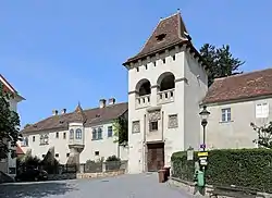 Maissau Fortress | |
 Coat of arms | |
 Maissau Location within Austria | |
| Coordinates: 48°34′N 15°49′E / 48.567°N 15.817°E | |
| Country | Austria |
| State | Lower Austria |
| District | Hollabrunn |
| Government | |
| • Mayor | Josef Klepp (ÖVP) |
| Area | |
| • Total | 43.14 km2 (16.66 sq mi) |
| Elevation | 341 m (1,119 ft) |
| Population (2018-01-01)[2] | |
| • Total | 1,946 |
| • Density | 45/km2 (120/sq mi) |
| Time zone | UTC+1 (CET) |
| • Summer (DST) | UTC+2 (CEST) |
| Postal code | 3712 |
| Area code | 02958 |
| Website | www.maissau.at |
Maissau is a municipality in the district of Hollabrunn in Lower Austria, Austria.
The Villages of the municipality are: Eggendorf am Walde, Grübern, Gumping, Klein-Burgstall, Limberg, Maissau, Oberdürnbach, Reikersdorf, Unterdürnbach and Wilhelmsdorf.
Population
| Year | Pop. | ±% |
|---|---|---|
| 1869 | 2,858 | — |
| 1880 | 2,856 | −0.1% |
| 1890 | 2,862 | +0.2% |
| 1900 | 2,851 | −0.4% |
| 1910 | 2,836 | −0.5% |
| 1923 | 2,573 | −9.3% |
| 1934 | 2,528 | −1.7% |
| 1939 | 2,456 | −2.8% |
| 1951 | 2,456 | +0.0% |
| 1961 | 2,236 | −9.0% |
| 1971 | 2,131 | −4.7% |
| 1981 | 1,804 | −15.3% |
| 1991 | 1,778 | −1.4% |
| 2001 | 1,855 | +4.3% |
| 2011 | 1,877 | +1.2% |
| 2021 | 1,938 | +3.2% |
References
- ↑ "Dauersiedlungsraum der Gemeinden Politischen Bezirke und Bundesländer - Gebietsstand 1.1.2018". Statistics Austria. Retrieved 10 March 2019.
- ↑ "Einwohnerzahl 1.1.2018 nach Gemeinden mit Status, Gebietsstand 1.1.2018". Statistics Austria. Retrieved 9 March 2019.
External links
Wikimedia Commons has media related to Maissau.
This article is issued from Wikipedia. The text is licensed under Creative Commons - Attribution - Sharealike. Additional terms may apply for the media files.