Lužianky | |
|---|---|
Municipality | |
 | |
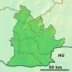 Lužianky Location of Lužianky in the Nitra Region 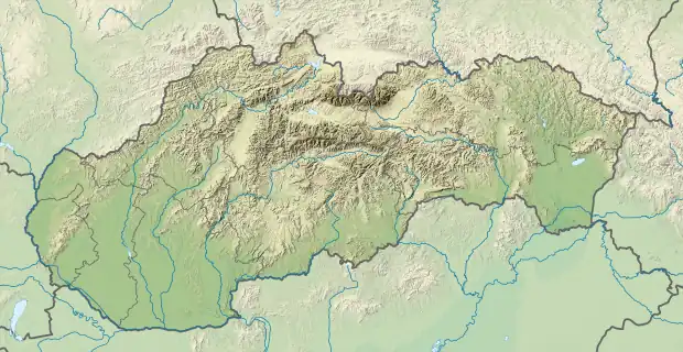 Lužianky Location of Lužianky in Slovakia | |
| Coordinates: 48°20′N 18°03′E / 48.333°N 18.050°E | |
| Country | |
| Region | Nitra |
| District | Nitra |
| First mentioned | 1113 |
| Area | |
| • Total | 12.42[1] km2 (4.80[1] sq mi) |
| Elevation | 154[2] m (505[2] ft) |
| Population (2021) | |
| • Total | 3,101[3] |
| Time zone | UTC+1 (CET) |
| • Summer (DST) | UTC+2 (CEST) |
| Postal code | 951 41[2] |
| Area code | +421 37[2] |
| Car plate | NR |
| Website | www |
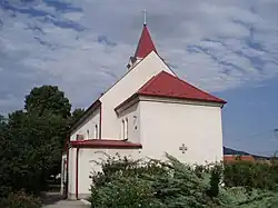
Lužianky (Hungarian: Sarlókajsza) is a village and municipality in the Nitra District in western central Slovakia, in the Nitra Region.[4]
History
In historical records the village was first mentioned in 1113.
Geography
The village lies at an altitude of 144 metres and covers an area of 12.426 km². It has a population of about 2535 people.
Ethnicity
The village is approximately 99% Slovak. 2 Brazilians
Facilities
The village has a public library a gym and football pitch.
References
- 1 2 "Hustota obyvateľstva - obce [om7014rr_ukaz: Rozloha (Štvorcový meter)]". www.statistics.sk (in Slovak). Statistical Office of the Slovak Republic. 2022-03-31. Retrieved 2022-03-31.
- 1 2 3 4 "Základná charakteristika". www.statistics.sk (in Slovak). Statistical Office of the Slovak Republic. 2015-04-17. Retrieved 2022-03-31.
- ↑ "Počet obyvateľov podľa pohlavia - obce (ročne)". www.statistics.sk (in Slovak). Statistical Office of the Slovak Republic. 2022-03-31. Retrieved 2022-03-31.
- ↑ "Lužianky - Okres Nitra - E-OBCE.sk".
External links
 Media related to Lužianky at Wikimedia Commons
- Official website

- https://web.archive.org/web/20080111223415/http://www.statistics.sk/mosmis/eng/run.html
This article is issued from Wikipedia. The text is licensed under Creative Commons - Attribution - Sharealike. Additional terms may apply for the media files.