Lužany pri Topli | |
|---|---|
Municipality | |
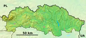 Lužany pri Topli Location of Lužany pri Topli in the Prešov Region  Lužany pri Topli Location of Lužany pri Topli in Slovakia | |
| Coordinates: 49°07′N 21°30′E / 49.117°N 21.500°E | |
| Country | |
| Region | Prešov |
| District | Svidník |
| First mentioned | 1399 |
| Area | |
| • Total | 3.240 km2 (1.251 sq mi) |
| Elevation | 180 m (590 ft) |
| Population | |
| • Total | 259 |
| • Density | 80/km2 (210/sq mi) |
| Time zone | UTC+1 (CET) |
| • Summer (DST) | UTC+2 (CEST) |
| Postal code | 087 01 (pošta Giraltovce) |
| Area code | +421-54 |
| Car plate | SK |
| Website | www |
Lužany pri Topli (Hungarian: Long) is a village and municipality in Svidník District in the Prešov Region of north-eastern Slovakia.
History
In historical records the village was first mentioned in 1399.
Geography
The municipality lies at an altitude of 180 metres and covers an area of 3.240 km². It has a population of about 259 people. The Topľa river flows near the village.
External links
 Media related to Lužany pri Topli at Wikimedia Commons
- Official website

- https://web.archive.org/web/20080111223415/http://www.statistics.sk/mosmis/eng/run.html
This article is issued from Wikipedia. The text is licensed under Creative Commons - Attribution - Sharealike. Additional terms may apply for the media files.