Lipovany | |
|---|---|
Municipality | |
 Lipovany panorama 2010 | |
 Lipovany Location of Lipovany in the Banská Bystrica Region  Lipovany Location of Lipovany in Slovakia | |
| Coordinates: 48°13′15″N 19°42′30″E / 48.2208°N 19.7083°E | |
| Country | |
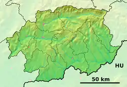
| Region | Banská Bystrica |
| District | Lučenec |
| First mentioned | 1238 |
| Area | |
| • Total | 10.34 km2 (3.99 sq mi) |
| Elevation | 215 m (705 ft) |
| Time zone | UTC+1 (CET) |
| • Summer (DST) | UTC+2 (CEST) |
| Postal code | 985 31 (pošta Rapovce) |
| Area code | +421-47 |
| Car plate | LC |
| Website | www.lipovany.sk |
Lipovany (Hungarian: Romhánypuszta) is a village and municipality in the Lučenec District in the Banská Bystrica Region of Slovakia.
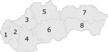
6: Banská Bystrica Region in Slovakia
External links
 Media related to Lipovany at Wikimedia Commons
- Official website

- https://web.archive.org/web/20080111223415/http://www.statistics.sk/mosmis/eng/run.html
This article is issued from Wikipedia. The text is licensed under Creative Commons - Attribution - Sharealike. Additional terms may apply for the media files.