Lightcliffe | |
|---|---|
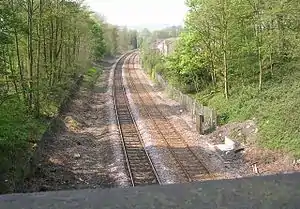 Site of the former Lightcliffe railway station. The platforms were either side of the line in the foreground up to the base of the bridge. | |
| General information | |
| Location | Lightcliffe, Calderdale England |
| Coordinates | 53°43′30″N 1°47′56″W / 53.725°N 1.799°W |
| Grid reference | SE133254 |
| Platforms | 2 |
| Other information | |
| Status | Disused |
| History | |
| Pre-grouping | Lancashire and Yorkshire Railway |
| Post-grouping | London, Midland and Scottish Railway |
| Key dates | |
| 1850 | opened |
| 1965 | closed |
Lightcliffe railway station served the village of Lightcliffe in West Yorkshire, England. It was opened in August 1850 and was a victim of the Beeching cuts on 14 June 1965.[1][2]
| Preceding station | Disused railways | Following station | ||
|---|---|---|---|---|
| Hipperholme | L&Y Caldervale line |
Wyke and Norwood Green |
Calderdale Lines |
|---|
Past, present and future |
References
- ↑ From Weaver to Web: Lightcliffe, Calderdale Council, retrieved 15 January 2012
- ↑ Quick, M. E. (2002). Railway passenger stations in England, Scotland and Wales – a chronology. Richmond: Railway and Canal Historical Society. p. 264. OCLC 931112387.
External links
This article is issued from Wikipedia. The text is licensed under Creative Commons - Attribution - Sharealike. Additional terms may apply for the media files.