Le Girouard | |
|---|---|
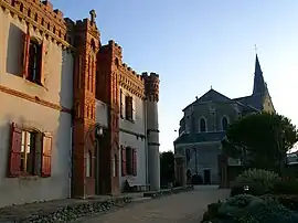 The church and the Château Gaillard, in the village | |
Location of Le Girouard | |
 Le Girouard 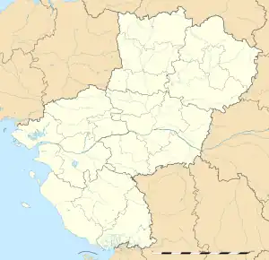 Le Girouard | |
| Coordinates: 46°34′08″N 1°35′54″W / 46.5689°N 1.5983°W | |
| Country | France |
| Region | Pays de la Loire |
| Department | Vendée |
| Arrondissement | Les Sables-d'Olonne |
| Canton | Talmont-Saint-Hilaire |
| Intercommunality | Pays des Achards |
| Government | |
| • Mayor (2022–2026) | Sandrine Decrock[1] |
| Area 1 | 25.10 km2 (9.69 sq mi) |
| Population | 1,120 |
| • Density | 45/km2 (120/sq mi) |
| Time zone | UTC+01:00 (CET) |
| • Summer (DST) | UTC+02:00 (CEST) |
| INSEE/Postal code | 85099 /85150 |
| Elevation | 14–72 m (46–236 ft) |
| 1 French Land Register data, which excludes lakes, ponds, glaciers > 1 km2 (0.386 sq mi or 247 acres) and river estuaries. | |
Le Girouard (French pronunciation: [lə ʒiʁwaʁ]) is a commune in the Vendée department in the Pays de la Loire region in western France.
Demography
| Year | Pop. | ±% p.a. |
|---|---|---|
| 1968 | 749 | — |
| 1975 | 616 | −2.75% |
| 1982 | 489 | −3.24% |
| 1990 | 466 | −0.60% |
| 1999 | 533 | +1.50% |
| 2007 | 761 | +4.55% |
| 2012 | 951 | +4.56% |
| 2017 | 1,050 | +2.00% |
| Source: INSEE[3] | ||
See also
References
- ↑ "Répertoire national des élus: les maires" (in French). data.gouv.fr, Plateforme ouverte des données publiques françaises. 6 June 2023.
- ↑ "Populations légales 2020". The National Institute of Statistics and Economic Studies. 29 December 2022.
- ↑ Population en historique depuis 1968, INSEE
Wikimedia Commons has media related to Le Girouard.
This article is issued from Wikipedia. The text is licensed under Creative Commons - Attribution - Sharealike. Additional terms may apply for the media files.