Lathus-Saint-Rémy | |
|---|---|
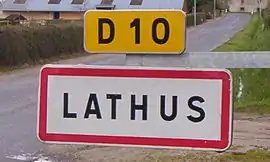 A sign entering Lathus, on the D10 road | |
Location of Lathus-Saint-Rémy | |
 Lathus-Saint-Rémy  Lathus-Saint-Rémy | |
| Coordinates: 46°20′04″N 0°57′33″E / 46.3344°N 0.9592°E | |
| Country | France |
| Region | Nouvelle-Aquitaine |
| Department | Vienne |
| Arrondissement | Montmorillon |
| Canton | Montmorillon |
| Government | |
| • Mayor (2020–2026) | Antoine Selosse[1] |
| Area 1 | 98.28 km2 (37.95 sq mi) |
| Population | 1,217 |
| • Density | 12/km2 (32/sq mi) |
| Time zone | UTC+01:00 (CET) |
| • Summer (DST) | UTC+02:00 (CEST) |
| INSEE/Postal code | 86120 /86390 |
| Elevation | 94–228 m (308–748 ft) (avg. 180 m or 590 ft) |
| 1 French Land Register data, which excludes lakes, ponds, glaciers > 1 km2 (0.386 sq mi or 247 acres) and river estuaries. | |
Lathus-Saint-Rémy (French pronunciation: [latys sɛ̃ ʁemi]), commonly known as Lathus, is a commune in the Vienne department, and the region of Nouvelle-Aquitaine, western France.
Geography
The Salleron forms most of the commune's eastern border.
See also
References
- ↑ "Répertoire national des élus: les maires" (in French). data.gouv.fr, Plateforme ouverte des données publiques françaises. 13 September 2022.
- ↑ "Populations légales 2020". The National Institute of Statistics and Economic Studies. 29 December 2022.
Wikimedia Commons has media related to Lathus-Saint-Rémy.
This article is issued from Wikipedia. The text is licensed under Creative Commons - Attribution - Sharealike. Additional terms may apply for the media files.