Labruyère-Dorsa | |
|---|---|
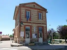 The town hall in Labruyère-Dorsa | |
Location of Labruyère-Dorsa | |
 Labruyère-Dorsa  Labruyère-Dorsa | |
| Coordinates: 43°24′29″N 1°28′14″E / 43.4081°N 1.4706°E | |
| Country | France |
| Region | Occitania |
| Department | Haute-Garonne |
| Arrondissement | Muret |
| Canton | Auterive |
| Government | |
| • Mayor (2020–2026) | Julien Godefroy[1] |
| Area 1 | 2.19 km2 (0.85 sq mi) |
| Population | 293 |
| • Density | 130/km2 (350/sq mi) |
| Time zone | UTC+01:00 (CET) |
| • Summer (DST) | UTC+02:00 (CEST) |
| INSEE/Postal code | 31256 /31190 |
| Elevation | 184–252 m (604–827 ft) (avg. 240 m or 790 ft) |
| 1 French Land Register data, which excludes lakes, ponds, glaciers > 1 km2 (0.386 sq mi or 247 acres) and river estuaries. | |
Labruyère-Dorsa (French pronunciation: [labʁɥijɛʁ dɔʁsa]; Occitan: La Bruguièra Dorçan) is a small rural village and commune in the Haute-Garonne department in southwestern France.
Geography
The commune is bordered by four other communes: Issus to the northeast, Auragne to the east, Auterive to the south, and finally by Grépiac to the west.
Population
| Year | Pop. | ±% |
|---|---|---|
| 1962 | 31 | — |
| 1968 | 59 | +90.3% |
| 1975 | 59 | +0.0% |
| 1982 | 55 | −6.8% |
| 1990 | 88 | +60.0% |
| 1999 | 143 | +62.5% |
| 2008 | 237 | +65.7% |
See also
References
- ↑ "Répertoire national des élus: les maires" (in French). data.gouv.fr, Plateforme ouverte des données publiques françaises. 13 September 2022.
- ↑ "Populations légales 2020". The National Institute of Statistics and Economic Studies. 29 December 2022.
Wikimedia Commons has media related to Labruyère-Dorsa.
This article is issued from Wikipedia. The text is licensed under Creative Commons - Attribution - Sharealike. Additional terms may apply for the media files.