Labastide-du-Haut-Mont
| |
|---|---|
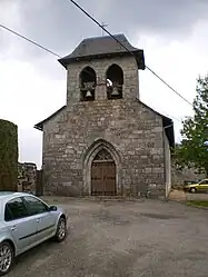 Église de l'Assomption-de-la-Vierge | |
Location of Labastide-du-Haut-Mont | |
 Labastide-du-Haut-Mont  Labastide-du-Haut-Mont | |
| Coordinates: 44°50′08″N 2°07′18″E / 44.8356°N 2.1217°E | |
| Country | France |
| Region | Occitania |
| Department | Lot |
| Arrondissement | Figeac |
| Canton | Lacapelle-Marival |
| Government | |
| • Mayor (2020–2026) | Sandrine Gavoille[1] |
| Area 1 | 9.85 km2 (3.80 sq mi) |
| Population | 48 |
| • Density | 4.9/km2 (13/sq mi) |
| Time zone | UTC+01:00 (CET) |
| • Summer (DST) | UTC+02:00 (CEST) |
| INSEE/Postal code | 46135 /46210 |
| Elevation | 577–776 m (1,893–2,546 ft) (avg. 784 m or 2,572 ft) |
| 1 French Land Register data, which excludes lakes, ponds, glaciers > 1 km2 (0.386 sq mi or 247 acres) and river estuaries. | |
Labastide-du-Haut-Mont (French pronunciation: [labastid dy o mɔ̃]; Occitan: La Bastida) is a rural commune in the Lot department in the Occitania region in Southwestern France. It is located on the departmental border with Cantal, which is also the regional border with Auvergne-Rhône-Alpes. In 2019, Labastide-du-Haut-Mont had a population of 50.
See also
References
- ↑ "Répertoire national des élus: les maires" (in French). data.gouv.fr, Plateforme ouverte des données publiques françaises. 4 May 2022.
- ↑ "Populations légales 2020". The National Institute of Statistics and Economic Studies. 29 December 2022.
Wikimedia Commons has media related to Labastide-du-Haut-Mont.
This article is issued from Wikipedia. The text is licensed under Creative Commons - Attribution - Sharealike. Additional terms may apply for the media files.