Kraľovany | |
|---|---|
Village | |
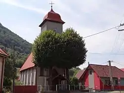 Protestant church | |
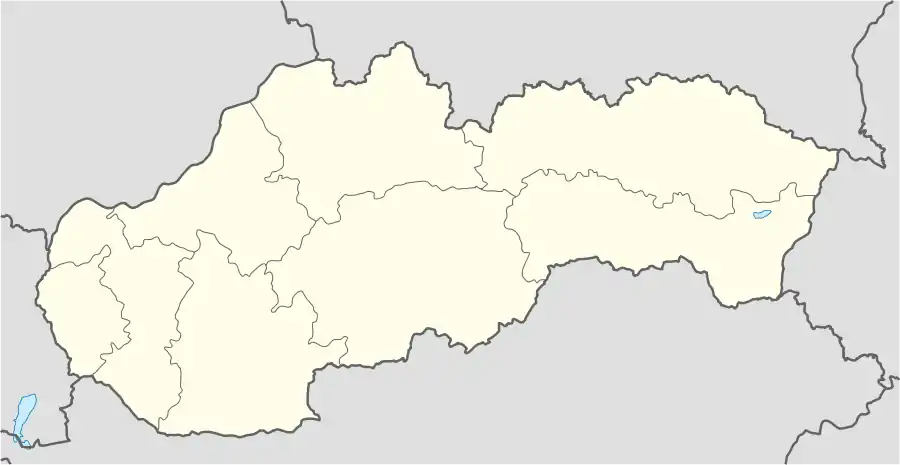 Kraľovany Location of Kraľovany in Slovakia | |
| Coordinates: 49°09′00″N 19°08′00″E / 49.15000°N 19.13333°E | |
| Country | Slovakia |
| Region | Žilina |
| District | Dolný Kubín |
| First mentioned | 1365 |
| Area | |
| • Total | 18.80[1] km2 (7.26[1] sq mi) |
| Elevation | 430[2] m (1,410[2] ft) |
| Population (2021) | |
| • Total | 428[3] |
| Postal code | 027 51[2] |
| Area code | +421 43[2] |
| Car plate | DK |
| Website | http://www.obeckralovany.sk/ |
| Source:[4] | |
Kraľovany (Hungarian: Kralován) is a village and municipality in Dolný Kubín District in the Žilina Region of northern Slovakia. It lies at the confluence of the Orava and Váh rivers.[5]
References
- 1 2 "Hustota obyvateľstva - obce [om7014rr_ukaz: Rozloha (Štvorcový meter)]". www.statistics.sk (in Slovak). Statistical Office of the Slovak Republic. 2022-03-31. Retrieved 2022-03-31.
- 1 2 3 4 "Základná charakteristika". www.statistics.sk (in Slovak). Statistical Office of the Slovak Republic. 2015-04-17. Retrieved 2022-03-31.
- ↑ "Počet obyvateľov podľa pohlavia - obce (ročne)". www.statistics.sk (in Slovak). Statistical Office of the Slovak Republic. 2022-03-31. Retrieved 2022-03-31.
- ↑ "Municipal Statistics". Statistical Office of the Slovak republic. Archived from the original on 2007-04-27. Retrieved 2007-05-03.
- ↑ DB City.com. retrieved Sept. 2012
Municipalities of Dolný Kubín District | ||
|---|---|---|
This article is issued from Wikipedia. The text is licensed under Creative Commons - Attribution - Sharealike. Additional terms may apply for the media files.