Korangi District
ضلع کورنگی ڪورنگي ضلعو | |
|---|---|
 Street in Korangi Town | |
 Seal | |
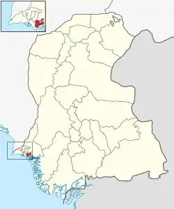 Map of Korangi District | |
| Country | |
| Province | |
| Division | Karachi |
| Established New Districts | 2013 |
| Headquarters[1] | DMC Korangi |
| Government | |
| • Type | Municipal corporation |
| • Body | DMC Korangi |
| • Deputy Commissioner | Saleemullah Odho[2] |
| • Administrator | Javed Rehman Kalwar[3] |
| Area | |
| • Total | 108 km2 (42 sq mi) |
| Population (2017)[4] | |
| • Total | 2,577,556 |
| • Density | 24,000/km2 (62,000/sq mi) |
| Website | dmckorangi |
Korangi District (Urdu: ضلع کورنگی) is one of the seven administrative districts of Karachi last modified in 2013, part of the Karachi Division in Sindh, Pakistan.
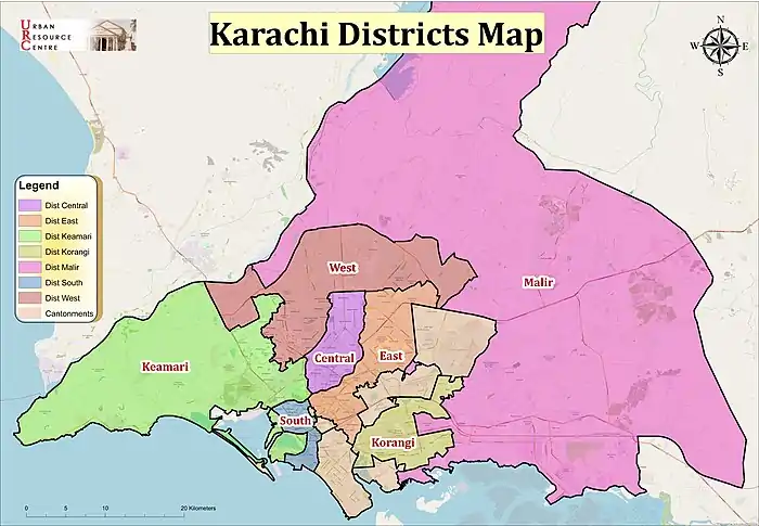
Map of Karachi Division
History
The district was a part of District East in Karachi, which was divided in November 2013.[5][6]
The district is diverse include Baloch, Pashtun, Sindhi, Punjabi and other ethnicities.[7]
The district suffers from water crisis and contamination issues. A reverse osmosis plant was inaugurated in Union Council 35 of District Municipal Corporation (DMC) Korangi on 6 March 2017.[8]
Demographics
At the time of the 2017 census, Korangi district had a population of 2,577,556, of which 1,347,161 were males and 1,229,899 females. The entire population was urban. The literacy rate is 80.19%: 81.56% for males and 78.68% for females.[4]
The majority religion is Islam, with 95.90% of the population. Christianity is practiced by 3.51% of the population.[4]
At the time of the 2017 census, 61.34% of the population spoke Urdu, 13.55% Punjabi, 5.80% Sindhi, 5.23% Pashto, 4.02% Saraiki and 3.55% Hindko as their first language.
Administrative towns
Korangi District has three administrative towns.[9]
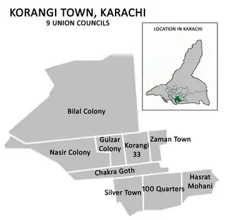
Korangi Town
| Union Council |
 |
|---|---|
| U.C. 1 Bilal Colony | |
| U.C. 2 Nasir Colony | |
| U.C. 3 Chakra Goth | |
| U.C. 4 Mustafa Taj Colony | |
| U.C. 5 Hundred Quarters | |
| U.C. 6 Gulzar Colony | |
| U.C. 7 Korangi Sector 33 | |
| U.C. 10 Korangi Sector 34 | |
| U.C. 8 Zaman Town | |
| U.C. 9 Hasrat Mohani Colony | |
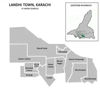
Landhi Town
| Union Council |
 |
|---|---|
| U.C. 1 Muzafarabad | |
| U.C. 2 Muslimabad | |
| U.C. 3 Dawood Chowrangi | |
| U.C. 4 Moinabad | |
| U.C. 5 Sharafi Goth | |
| U.C. 6 Bhutto Nagar | |
| U.C. 7 Khawaja Ajmeer Colony | |
| U.C. 8 Landhi | |
| U.C. 9 Awami Colony | |
| U.C. 10 Burmee Colony | |
| U.C. 11 Korangi | |
| U.C. 12 Sherabad | |
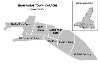
Shah Faisal Town
| Union Council |
 |
|---|---|
| U.C. 1 Natha Khan Goth | |
| U.C. 2 Pak Sadat Colony | |
| U.C. 3 Drigh Colony | |
| U.C. 4 Raita Plot | |
| U.C. 5 Moria Khan Goth | |
| U.C. 6 Albadar | |
| U.C. 7 Al-Falah Society | |
List of Dehs
The following is a list of Korangi District's dehs, organised by taluka:
- Shah Faisal taluka (2 dehs)
- Model Colony taluka (2 dehs)
- Mehran-II
- Thano-II
- Landhi taluka (2 dehs)
- Phihai-II
- Sahrafi-I
- Korangi taluka (2 dehs)
- Dih
- Phihai-I
See also
References
- ↑ "ADMINISTRATIVE DISTRICTS". Commissioner, Karachi Division.
- ↑ "Commissioner orders steps to resolve fire safety issues in industrial areas". The News International (newspaper). 10 November 2021. Retrieved 11 January 2022.
- ↑ "50 buses for Karachi to arrive by January 31, says Wahab". The News International (newspaper). 30 December 2021. Retrieved 11 January 2022.
- 1 2 3 4 "District-wise Tables - Census 2017 Final Results". pbs.gov.pk. Pakistan Bureau of Statistics. 2017.
- ↑ Mansoor, Hasan (6 November 2013). "Korangi notified as sixth district of Karachi". Dawn (newspaper). Pakistan. Retrieved 6 March 2022.
- ↑ "Korangi made sixth district of Karachi" The News International (newspaper)
- ↑ District Korangi: Karachi’s newest district looks to new beginnings The Express Tribune (newspaper), Published 10 July 2018, Retrieved 6 March 2022
- ↑ "New RO plant opened in Korangi". The News International (newspaper). Retrieved 6 March 2022.
- ↑ "Districts in Karachi (districts further divided and new district added in 2013 - Korangi District)". Karachi Metropolitan Corporation website. 1 March 2013. Archived from the original on 30 May 2014. Retrieved 4 March 2022.
24°53′04″N 67°08′39″E / 24.8844°N 67.1443°E
Provincial capital: Karachi | ||
| Banbhore | 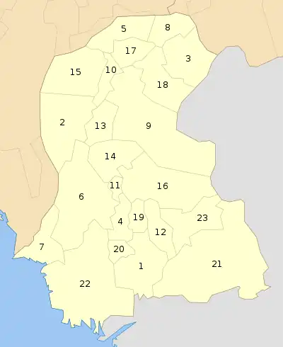 | |
| Hyderabad | ||
| Karachi | ||
| Larkana | ||
| Mirpur Khas | ||
| Sukkur | ||
| Shaheed Benazir Abad | ||