Kirchberg ob der Donau | |
|---|---|
 | |
 Coat of arms | |
 Location in the district | |
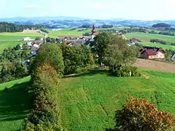
 Kirchberg ob der Donau Location within Austria | |
| Coordinates: 48°26′42″N 13°56′10″E / 48.44500°N 13.93611°E | |
| Country | Austria |
| State | Upper Austria |
| District | Rohrbach |
| Government | |
| • Mayor | Franz Hofer (ÖVP) |
| Area | |
| • Total | 21.33 km2 (8.24 sq mi) |
| Elevation | 591 m (1,939 ft) |
| Population (2018-01-01)[2] | |
| • Total | 1,055 |
| • Density | 49/km2 (130/sq mi) |
| Time zone | UTC+1 (CET) |
| • Summer (DST) | UTC+2 (CEST) |
| Postal code | 4131 |
| Area code | 07282 |
| Vehicle registration | RO |
| Website | www.kirchberg-donau.at |
Kirchberg ob der Donau is a municipality in the district of Rohrbach in the Austrian state of Upper Austria.
Population
| Year | Pop. | ±% |
|---|---|---|
| 1869 | 1,178 | — |
| 1880 | 1,268 | +7.6% |
| 1890 | 1,290 | +1.7% |
| 1900 | 1,163 | −9.8% |
| 1910 | 1,233 | +6.0% |
| 1923 | 1,266 | +2.7% |
| 1934 | 1,232 | −2.7% |
| 1939 | 1,191 | −3.3% |
| 1951 | 1,117 | −6.2% |
| 1961 | 1,047 | −6.3% |
| 1971 | 1,116 | +6.6% |
| 1981 | 1,115 | −0.1% |
| 1991 | 1,108 | −0.6% |
| 2001 | 1,123 | +1.4% |
| 2011 | 1,084 | −3.5% |
| 2015 | 1,048 | −3.3% |
References
- ↑ "Dauersiedlungsraum der Gemeinden Politischen Bezirke und Bundesländer - Gebietsstand 1.1.2018". Statistics Austria. Retrieved 10 March 2019.
- ↑ "Einwohnerzahl 1.1.2018 nach Gemeinden mit Status, Gebietsstand 1.1.2018". Statistics Austria. Retrieved 9 March 2019.
Wikimedia Commons has media related to Kirchberg ob der Donau.
This article is issued from Wikipedia. The text is licensed under Creative Commons - Attribution - Sharealike. Additional terms may apply for the media files.