Kematen an der Krems | |
|---|---|
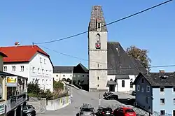 Church of Saint Martin | |
 Coat of arms | |
 Kematen an der Krems Location within Austria | |
| Coordinates: 48°6′41″N 14°11′32″E / 48.11139°N 14.19222°E | |
| Country | Austria |
| State | Upper Austria |
| District | Linz-Land |
| Government | |
| • Mayor | Markus Stadlbauer (ÖVP) |
| Area | |
| • Total | 21.54 km2 (8.32 sq mi) |
| Elevation | 327 m (1,073 ft) |
| Population (2018-01-01)[2] | |
| • Total | 2,790 |
| • Density | 130/km2 (340/sq mi) |
| Time zone | UTC+1 (CET) |
| • Summer (DST) | UTC+2 (CEST) |
| Postal code | 4531 |
| Area code | 07228 |
| Vehicle registration | LL |
| Website | www.kematen.at |
Kematen an der Krems is a municipality in the district Linz-Land in the Austrian state of Upper Austria.
Population
| Year | Pop. | ±% |
|---|---|---|
| 1869 | 1,539 | — |
| 1880 | 1,608 | +4.5% |
| 1890 | 1,586 | −1.4% |
| 1900 | 1,585 | −0.1% |
| 1910 | 1,620 | +2.2% |
| 1923 | 1,665 | +2.8% |
| 1934 | 1,738 | +4.4% |
| 1939 | 1,652 | −4.9% |
| 1951 | 1,742 | +5.4% |
| 1961 | 1,618 | −7.1% |
| 1971 | 1,679 | +3.8% |
| 1981 | 1,783 | +6.2% |
| 1991 | 1,883 | +5.6% |
| 2001 | 2,225 | +18.2% |
| 2011 | 2,510 | +12.8% |
References
- ↑ "Dauersiedlungsraum der Gemeinden Politischen Bezirke und Bundesländer - Gebietsstand 1.1.2018". Statistics Austria. Retrieved 10 March 2019.
- ↑ "Einwohnerzahl 1.1.2018 nach Gemeinden mit Status, Gebietsstand 1.1.2018". Statistics Austria. Retrieved 9 March 2019.
Wikimedia Commons has media related to Kematen an der Krems.
This article is issued from Wikipedia. The text is licensed under Creative Commons - Attribution - Sharealike. Additional terms may apply for the media files.