| Kapka Tash Lake | |
|---|---|
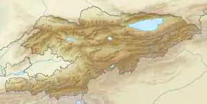 Kapka Tash Lake  Kapka Tash Lake | |
| Coordinates | 41°31′19″N 73°19′56″E / 41.52194°N 73.33222°E |
| Basin countries | Kyrgyzstan |
| Max. length | 1.5 km (0.93 mi) |
| Max. width | 0.7 km (0.43 mi) |
| Surface area | 1.0 km2 (0.39 sq mi) |
| Water volume | 21×106 m3 (740×106 cu ft) |
| Surface elevation | 2,303 m (7,556 ft) |
Kapka Tash Lake (Kyrgyz: Капка Таш) is a rock-dammed lake in Toktogul District of Jalal-Abad Province of Kyrgyzstan. It is located at the altitude of 2303 m in riverbed of Kara-Suu, left tributary of Naryn River.[1]
References
- ↑ Атлас Кыргызской Республики [Atlas of Kyrgyz Republic] (in Russian). Bishkek: Academy of Sciences of Kyrgyz SSR. 1987. p. 156.
| |
This article is issued from Wikipedia. The text is licensed under Creative Commons - Attribution - Sharealike. Additional terms may apply for the media files.