Kaharole
কাহারোল | |
|---|---|
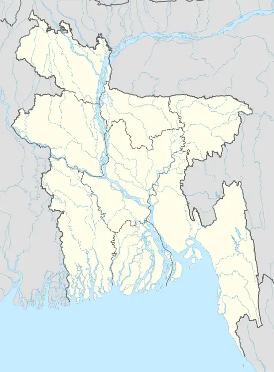 Kaharole Location in Bangladesh | |
| Coordinates: 25°47.5′N 88°36′E / 25.7917°N 88.600°E | |
| Country | |
| Division | Rangpur Division |
| District | Dinajpur District |
| Area | |
| • Total | 205.54 km2 (79.36 sq mi) |
| Population (1991) | |
| • Total | 118,379 |
| • Density | 576/km2 (1,490/sq mi) |
| Time zone | UTC+6 (BST) |
| Website | Official Map of Kaharole |
.jpg.webp)
Kaharole Upazila (Bengali: কাহারোল) is an upazila of Dinajpur District in the Division of Rangpur, Bangladesh.[1]
Geography
Kaharole Upazila is bounded by Birganj Upazila on the north, Dinajpur Sadar Upazila and Biral Upazila on the south, Khansama and Dinajpur Sadar Upazila on the east, and Bochaganj Upazila on the west.[2]
Kaharole is located at 25°47′30″N 88°36′00″E / 25.7917°N 88.6000°E. It has 22,448 households and a total area of 205.54 km2.
Demographics
As of the 1991 Bangladesh census, Kaharole has a population of 118,379. Males constitute 51.78% of the population, and females 48.22%. Kaharole's population over 18 years old is 60,240.
Administration
Kaharole, which was formed in 1904 as a Thana, was turned into an upazila in 1984.[2]
Kaharole Upazila is divided into six union parishads: Dabor, Mukundapur, Ramchandrapur, Rasulpur, Sundarpur, and Targaon. The union parishads are subdivided into 153 mauzas and 152 villages.[3]
References
- ↑ Md Ali Hossain (2012), "Kaharole Upazila", in Sirajul Islam and Ahmed A. Jamal (ed.), Banglapedia: National Encyclopedia of Bangladesh (Second ed.), Asiatic Society of Bangladesh
- 1 2 "Kaharole Upazila - Banglapedia". en.banglapedia.org. Retrieved 2023-02-20.
- ↑ "District Statistics 2011: Dinajpur" (PDF). Bangladesh Bureau of Statistics. Archived from the original (PDF) on 13 November 2014. Retrieved 14 July 2014.
Capital: Dinajpur | ||
| Upazilas | ||
| Constituencies | ||
| Attractions and sites | ||
| History | ||
| Inhabited areas | ||
| Educational institutions | ||
| Transport | ||
| See also |
| |
Capital: Rangpur | ||
| Dinajpur District | 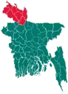 | |
| Gaibandha District | ||
| Kurigram District | ||
| Lalmonirhat District | ||
| Nilphamari District | ||
| Panchagarh District | ||
| Rangpur District | ||
| Thakurgaon District | ||