Hontianske Tesáre | |
|---|---|
Municipality | |
 | |
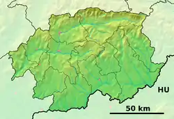 Hontianske Tesáre Location of Hontianske Tesáre in the Banská Bystrica Region 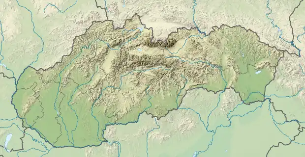 Hontianske Tesáre Location of Hontianske Tesáre in Slovakia | |
| Coordinates: 48°12′N 18°55′E / 48.200°N 18.917°E | |
| Country | |
| Region | Banská Bystrica |
| District | Krupina |
| First mentioned | 1279 |
| Area | |
| • Total | 33.11[1] km2 (12.78[1] sq mi) |
| Elevation | 162[2] m (531[2] ft) |
| Population (2021) | |
| • Total | 882[3] |
| Time zone | UTC+1 (CET) |
| • Summer (DST) | UTC+2 (CEST) |
| Postal code | 962 68[2] |
| Area code | +421 45[2] |
| Car plate | KA |
| Website | www.hontiansketesare.sk |
Hontianske Tesare (Hungarian: Teszér) is a village and municipality in the Krupina District of the Banská Bystrica Region of Slovakia.
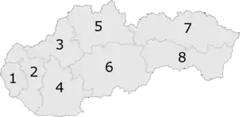
6: Banská Bystrica Region
Genealogical resources
The records for genealogical research are available at the state archive "Statny Archiv in Banska Bystrica, Slovakia"
- Roman Catholic church records (births/marriages/deaths): 1760-1897 (parish B)
- Lutheran church records (births/marriages/deaths): 1702-1902 (parish A)
See also
References
- 1 2 "Hustota obyvateľstva - obce [om7014rr_ukaz: Rozloha (Štvorcový meter)]". www.statistics.sk (in Slovak). Statistical Office of the Slovak Republic. 2022-03-31. Retrieved 2022-03-31.
- 1 2 3 4 "Základná charakteristika". www.statistics.sk (in Slovak). Statistical Office of the Slovak Republic. 2015-04-17. Retrieved 2022-03-31.
- ↑ "Počet obyvateľov podľa pohlavia - obce (ročne)". www.statistics.sk (in Slovak). Statistical Office of the Slovak Republic. 2022-03-31. Retrieved 2022-03-31.
External links
 Media related to Hontianske Tesáre at Wikimedia Commons
- Official website

- Surnames of living people in Hontianske Tesare
This article is issued from Wikipedia. The text is licensed under Creative Commons - Attribution - Sharealike. Additional terms may apply for the media files.