Hollenthon | |
|---|---|
.jpg.webp) Panoramic view | |
 Coat of arms | |
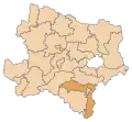
 Hollenthon Location within Austria | |
| Coordinates: 47°35′24″N 16°15′33″E / 47.59000°N 16.25917°E | |
| Country | Austria |
| State | Lower Austria |
| District | Wiener Neustadt-Land |
| Government | |
| • Mayor | Manfred Grundtner (ÖVP) |
| Area | |
| • Total | 23.8 km2 (9.2 sq mi) |
| Elevation | 661 m (2,169 ft) |
| Population (2018-01-01)[2] | |
| • Total | 1,018 |
| • Density | 43/km2 (110/sq mi) |
| Time zone | UTC+1 (CET) |
| • Summer (DST) | UTC+2 (CEST) |
| Postal code | 2812 |
| Area code | 02645 |
| Vehicle registration | WB |
| Website | www.hollenthon.at |
Hollenthon is a municipality in the district of Wiener Neustadt-Land in the Austrian state of Lower Austria.
Population
| Year | Pop. | ±% |
|---|---|---|
| 1971 | 1,047 | — |
| 1981 | 1,033 | −1.3% |
| 1991 | 1,000 | −3.2% |
| 2001 | 1,048 | +4.8% |
References
- ↑ "Dauersiedlungsraum der Gemeinden Politischen Bezirke und Bundesländer - Gebietsstand 1.1.2018". Statistics Austria. Retrieved 10 March 2019.
- ↑ "Einwohnerzahl 1.1.2018 nach Gemeinden mit Status, Gebietsstand 1.1.2018". Statistics Austria. Retrieved 9 March 2019.
This article is issued from Wikipedia. The text is licensed under Creative Commons - Attribution - Sharealike. Additional terms may apply for the media files.