Hohes Kreuz | |
|---|---|
 Coat of arms | |
Location of Hohes Kreuz within Eichsfeld district 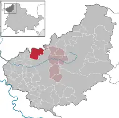 | |
 Hohes Kreuz 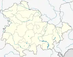 Hohes Kreuz | |
| Coordinates: 51°25′31″N 10°5′36″E / 51.42528°N 10.09333°E | |
| Country | Germany |
| State | Thuringia |
| District | Eichsfeld |
| Municipal assoc. | Leinetal |
| Subdivisions | 4 Ortsteile |
| Government | |
| • Mayor (2022–28) | Matthias Heß[1] |
| Area | |
| • Total | 17.96 km2 (6.93 sq mi) |
| Elevation | 347 m (1,138 ft) |
| Population (2021-12-31)[2] | |
| • Total | 1,246 |
| • Density | 69/km2 (180/sq mi) |
| Time zone | UTC+01:00 (CET) |
| • Summer (DST) | UTC+02:00 (CEST) |
| Postal codes | 37308 |
| Dialling codes | 03606 |
| Vehicle registration | EIC |
| Website | www.vg-leinetal.de |
Hohes Kreuz (German pronunciation: [ˈhoːəs ˈkʁɔʏts]) is a municipality in the Eichsfeld in Thuringia, Germany. The municipality was created in 1991 by merging the municipalities of Bischhagen, Mengelrode, Siemerode, and Streitholz.
References
- ↑ Gewählte Bürgermeister - aktuelle Landesübersicht, Freistaat Thüringen, accessed 10 November 2022.
- ↑ "Bevölkerung der Gemeinden, erfüllenden Gemeinden und Verwaltungsgemeinschaften in Thüringen Gebietsstand: 31.12.2021" (in German). Thüringer Landesamt für Statistik. June 2022.
This article is issued from Wikipedia. The text is licensed under Creative Commons - Attribution - Sharealike. Additional terms may apply for the media files.