Hill City | |
|---|---|
| Hill City | |
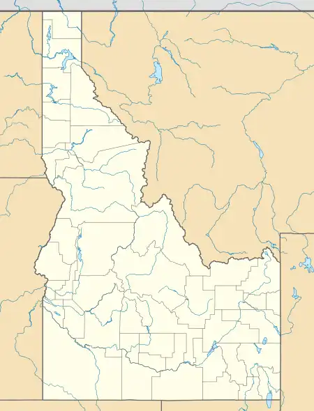 Hill City Location within the state of Idaho | |
| Coordinates: 43°18′02″N 115°03′04″W / 43.30056°N 115.05111°W | |
| Country | United States |
| State | Idaho |
| County | Camas |
| Population (2012) | |
| • Total | 26 [1] |
| Time zone | UTC-7 (Mountain (MST)) |
| • Summer (DST) | UTC-6 (MDT) |
| ZIP codes | 83337 |
| Area code | 208[2] |
| Website | None |
Hill City is an unincorporated community in southwestern Camas County, Idaho, United States.
It lies at the intersection of U.S. Route 20 with Mink and Swamp Roads and Trader Lane, 14 miles (22½ km) west-southwest of Fairfield, the county seat.
History
Hill City was named for the Bennet Mountain Hills, located nearby, and in 1911, Hill City became the a major station on the Oregon Short Line Railroad. From Hill City and the surrounding Camas Prairie, astonishing numbers of sheep were shipped. At one time, more sheep were shipped from Hill City than anywhere else in the world.
Hill City's population was 30 in 1960.[3]
There were also many grain elevators in the area. There is a historic saloon, reopened in 2013. They sell basic food and local crafts.
The elevation of Hill City is 5,090 feet (1,551 m) above sea level.
Climate
| Climate data for Hill City 1 W, Idaho, 1991–2020 normals, 1915-2020 extremes: 5100ft (1554m) | |||||||||||||
|---|---|---|---|---|---|---|---|---|---|---|---|---|---|
| Month | Jan | Feb | Mar | Apr | May | Jun | Jul | Aug | Sep | Oct | Nov | Dec | Year |
| Record high °F (°C) | 50 (10) |
59 (15) |
70 (21) |
83 (28) |
91 (33) |
98 (37) |
102 (39) |
100 (38) |
98 (37) |
85 (29) |
73 (23) |
59 (15) |
102 (39) |
| Mean maximum °F (°C) | 40.2 (4.6) |
42.9 (6.1) |
54.9 (12.7) |
70.3 (21.3) |
80.1 (26.7) |
87.3 (30.7) |
95.7 (35.4) |
93.5 (34.2) |
87.3 (30.7) |
77.7 (25.4) |
56.7 (13.7) |
42.3 (5.7) |
92.5 (33.6) |
| Average high °F (°C) | 29.0 (−1.7) |
31.8 (−0.1) |
42.1 (5.6) |
54.3 (12.4) |
64.9 (18.3) |
74.5 (23.6) |
85.2 (29.6) |
85.1 (29.5) |
75.7 (24.3) |
60.6 (15.9) |
43.1 (6.2) |
30.4 (−0.9) |
56.4 (13.6) |
| Daily mean °F (°C) | 19.1 (−7.2) |
21.8 (−5.7) |
31.4 (−0.3) |
41.5 (5.3) |
50.0 (10.0) |
57.4 (14.1) |
66.0 (18.9) |
64.9 (18.3) |
56.3 (13.5) |
44.4 (6.9) |
31.4 (−0.3) |
20.5 (−6.4) |
42.1 (5.6) |
| Average low °F (°C) | 9.2 (−12.7) |
11.7 (−11.3) |
20.8 (−6.2) |
28.8 (−1.8) |
35.1 (1.7) |
40.3 (4.6) |
46.8 (8.2) |
44.8 (7.1) |
36.9 (2.7) |
28.1 (−2.2) |
19.6 (−6.9) |
10.6 (−11.9) |
27.7 (−2.4) |
| Mean minimum °F (°C) | −14.7 (−25.9) |
−13.2 (−25.1) |
−0.1 (−17.8) |
15.9 (−8.9) |
22.7 (−5.2) |
26.1 (−3.3) |
35.6 (2.0) |
31.5 (−0.3) |
23.1 (−4.9) |
10.1 (−12.2) |
−3.2 (−19.6) |
−12.5 (−24.7) |
−20.2 (−29.0) |
| Record low °F (°C) | −44 (−42) |
−40 (−40) |
−26 (−32) |
−8 (−22) |
14 (−10) |
19 (−7) |
21 (−6) |
21 (−6) |
8 (−13) |
−10 (−23) |
−23 (−31) |
−49 (−45) |
−49 (−45) |
| Average precipitation inches (mm) | 2.06 (52) |
1.22 (31) |
1.17 (30) |
1.20 (30) |
1.28 (33) |
0.80 (20) |
0.47 (12) |
0.24 (6.1) |
0.52 (13) |
1.05 (27) |
1.26 (32) |
2.72 (69) |
13.99 (355.1) |
| Average snowfall inches (cm) | 27.6 (70) |
13.4 (34) |
5.3 (13) |
1.8 (4.6) |
0.0 (0.0) |
0.0 (0.0) |
0.0 (0.0) |
0.0 (0.0) |
0.0 (0.0) |
0.5 (1.3) |
8.3 (21) |
27.2 (69) |
84.1 (212.9) |
| Source 1: NOAA[4] | |||||||||||||
| Source 2: XMACIS2 (1991-2006 snowfall, records & monthly max/mins)[5] | |||||||||||||
References
See also

Municipalities and communities of Camas County, Idaho, United States | ||
|---|---|---|
| City | Map of Idaho highlighting Camas County | |
| Unincorporated communities | ||