Harpalpur
Harpālpur | |
|---|---|
Populated place | |
 Map showing Harpalpur (#797) in Harpalpur CD block | |
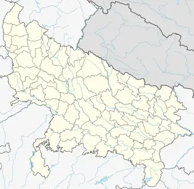 Harpalpur Location in Uttar Pradesh, India 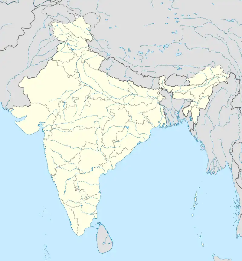 Harpalpur Harpalpur (India) | |
| Coordinates: 27°19′29″N 79°50′22″E / 27.324631°N 79.839526°E[1] | |
| Country | |
| State | Uttar Pradesh |
| District | Hardoi |
| Area | |
| • Total | 4.912 km2 (1.897 sq mi) |
| Population (2011)[2] | |
| • Total | 8,822 |
| • Density | 1,800/km2 (4,700/sq mi) |
| Languages | |
| • Official | Hindi |
| Time zone | UTC+5:30 (IST) |
Harpalpur is a village and corresponding community development block in Sawayajpur tehsil of Hardoi district, Uttar Pradesh, India.[2] It is located west of Sandi, on the road to Fatehgarh.[3] The main staple crops here are wheat, rice,[4] and maize.[5] Markets are held twice weekly.[4][5] As of 2011, the population of Harpalpur is 8,822, in 1,544 households.[2] The total block population is 172,224, in 29,232 households.[2]
History
Around the turn of the 20th century, Harpalpur's main landowner was the Rani of Katiari, who held the village on a permanent settlement.[3] It had become the site of a police station, which was previously located in the neighbouring village of Palia.[3] As of the 1901 census, its population was 1,182, including 91 Muslims.[3]
The 1961 census recorded Harpalpur as comprising 3 hamlets, with a total population of 1,779 (968 male and 811 female), in 368 households and 214 physical houses.[6] The area of the village was given as 1,295 acres.[6] Amenities recorded at the time included a medical practitioner, a hospital, and a post office.[6]
The 1981 census recorded Harpalpur as having a population of 344, in 64 households, and covering an area of 497.38 hectares.[5]
Villages
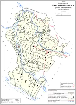
Harpalpur CD block has the following 113 villages:[2]
| Village name | Total land area (hectares) | Population (in 2011) |
|---|---|---|
| Saee | 397.4 | 459 |
| Jeuri | 539.1 | 230 |
| Barhauli | 33.7 | 622 |
| Gauria Sisala | 251.3 | 1,149 |
| Gauria Pansala | 164.8 | 0 |
| Ghorhi Thar | 355.8 | 1,885 |
| Mubarakpur | 91.1 | 429 |
| Bamh Rauli | 414.1 | 2,346 |
| Bhupatipur Nagar | 276.4 | 1,763 |
| Chatkapur | 45.9 | 451 |
| Bamtapur Nand Bagh | 317.2 | 1,230 |
| Shahabuddinpur | 449.2 | 2,277 |
| Sanjhara | 207.7 | 410 |
| Auhadpur | 235.3 | 1,078 |
| Kakrauaa | 438.7 | 2,591 |
| Padamlapur | 139 | 720 |
| Aliganj Nan Kheriya | 873.9 | 2,105 |
| Nagriya Cut | 128.5 | 916 |
| Kudha | 162.9 | 550 |
| Arjunpur Sisala | 474.9 | 4,387 |
| Arjunpur Pansala | 127.6 | 0 |
| Sidheypur | 80.4 | 0 |
| Bhawanipur | 80.1 | 560 |
| Molhanpur Pansala | 202.5 | 0 |
| Molhanpur Sisala | 263.1 | 2,144 |
| Surjoopur Durjana Sisala | 287.1 | 1,580 |
| Surjoopur Durjana Pansala | 223.5 | 81 |
| Tithi Gaon Sisala | 190.5 | 2,235 |
| Tithi Gaon Pansala | 384.2 | 0 |
| Bari (Barra) | 400.7 | 1,811 |
| Sirsa | 85.4 | 1,514 |
| Nagra Choudharpur | 448.2 | 2,500 |
| Mirgawan | 318.1 | 2,242 |
| Nagriya Sadhau | 84.5 | 569 |
| Pithnapur | 281.3 | 1,063 |
| Muthauli | 74.4 | 33 |
| Mahsoolapur | 122.5 | 2,210 |
| Haraiya | 89.7 | 365 |
| Mahua Koli | 89.4 | 562 |
| Choudhariapur | 253.6 | 653 |
| Sultanpur | 70 | 229 |
| Jeuri Chandrampur | 340.6 | 2,063 |
| Barsana | 169.8 | 311 |
| Newada | 295.5 | 1,093 |
| Khamhaura Pansala | 135.5 | 0 |
| Khamhaura Sisala | 115.2 | 1,092 |
| Gadnapur | 135.9 | 911 |
| Khasaura | 614.7 | 7,260 |
| Surjupur | 112 | 850 |
| Sildaspur | 2.6 | 0 |
| Shyampur | 360.2 | 1,489 |
| Behta Rampura | 247 | 2,061 |
| Dharampur | 409.4 | 3,286 |
| Chaunpur | 365.8 | 1,928 |
| Barha Gaon | 234.9 | 1,642 |
| Nagra | 2.5 | 0 |
| Gangeypur | 260.2 | 0 |
| Rabiapur | 81.8 | 209 |
| Kharagpur | 89.6 | 479 |
| Bari | 221.9 | 583 |
| Bundapur | 63.7 | 540 |
| Saresar | 131.7 | 803 |
| Karak Chamau | 307.4 | 1,343 |
| Satautha | 797.6 | 3,992 |
| Bhusehra | 406.4 | 2,486 |
| Malautha | 559.1 | 4,432 |
| Harpalpur (block headquarters) | 491.2 | 8,822 |
| Roshanpur | 439.4 | 2,052 |
| Bansy | 381.4 | 1,737 |
| Kakra | 716.3 | 5,746 |
| Iknaura | 315.3 | 2,165 |
| Rani Khera | 62.7 | 989 |
| Deorania | 39.4 | 259 |
| Kathetha | 203.4 | 2,517 |
| Palia Sisala | 531 | 9,250 |
| Palia Pansala | 135 | 539 |
| Gadherha | 44.6 | 273 |
| Mahdain Kalan | 109.8 | 505 |
| Mahday Khurd | 97.9 | 546 |
| Kiratpur | 0 | 0 |
| Ghatwasa | 262.8 | 2,449 |
| Bhatauli Dharam | 407.8 | 2,709 |
| Laluwa Mau | 319 | 3,039 |
| Dhania Mau | 420.2 | 2,005 |
| Shekhapur Nagria Kadim | 269.3 | 1,854 |
| Shekhapur Nagria Jadid | 269.3 | 0 |
| Chanda Mohammadpur Sisala | 350.4 | 2,819 |
| Chanda Mohammadpur Pansala | 90.6 | 0 |
| Manduwdpur Narautha | 360.4 | 847 |
| Kharuddinpur | 218.6 | 1,304 |
| Baran | 323.4 | 1,171 |
| Surjanapur | 69.4 | 327 |
| Didwan | 162.9 | 480 |
| Mastapur | 147.8 | 281 |
| Parchauli | 372.3 | 2,501 |
| Dayalpur | 421.9 | 2,534 |
| Pura Anta | 55.8 | 490 |
| Ismailpur | 116.5 | 756 |
| Tikar | 178.1 | 1,351 |
| Poora Ratan | 128.7 | 723 |
| Beerhijor | 344.8 | 2,236 |
| Gadanpur | 279 | 0 |
| Bara Mau Sisala | 278.8 | 1,534 |
| Bara Mau Pansala | 1,052.1 | 622 |
| Dhak Pura | 275.7 | 1,304 |
| Dahalitha | 1,700.9 | 7,440 |
| Murwa Shahabuddinpur | 254.4 | 1,608 |
| Ram Nagar | 60 | 471 |
| Murcha | 375.4 | 753 |
| Behta Lakhi | 125.8 | 1,108 |
| Alampur | 158.7 | 984 |
| Arwal Paschim | 707.6 | 5,925 |
| Arwal Poorab | 707.6 | 397 |
References
- ↑ Search for "Harpalpur" here https://geonames.nga.mil/namesgaz/.
{{cite web}}: Missing or empty|title=(help) - 1 2 3 4 5 6 "Census of India 2011: Uttar Pradesh District Census Handbook - Hardoi, Part A (Village and Town Directory)" (PDF). Census 2011 India. pp. 206–30. Retrieved 29 May 2021.
- 1 2 3 4 Nevill, H.R. (1904). Hardoi - A Gazetteer. Allahabad: Government Press. p. 203. Retrieved 29 May 2021.
- 1 2 Census 1971 Uttar Pradesh: District Census Handbook Part X-A: Village & Town Directory, District Hardoi (PDF). 1972. pp. 128–9. Retrieved 29 May 2021.
- 1 2 3 Census 1981 Uttar Pradesh: District Census Handbook Part XIII-A: Village & Town Directory, District Hardoi (PDF). 1982. pp. 172–3. Retrieved 29 May 2021.
- 1 2 3 Census 1961: District Census Handbook, Uttar Pradesh (36 - Hardoi District) (PDF). Lucknow. 1965. pp. 158, xciv-xcv of section "Bilgram Tahsil". Retrieved 29 May 2021.
{{cite book}}: CS1 maint: location missing publisher (link)