Frontenay-Rohan-Rohan | |
|---|---|
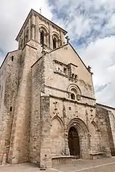 St. Peter's church | |
.svg.png.webp) Coat of arms | |
Location of Frontenay-Rohan-Rohan | |
 Frontenay-Rohan-Rohan  Frontenay-Rohan-Rohan | |
| Coordinates: 46°15′20″N 0°32′19″W / 46.2556°N 0.5386°W | |
| Country | France |
| Region | Nouvelle-Aquitaine |
| Department | Deux-Sèvres |
| Arrondissement | Niort |
| Canton | Frontenay-Rohan-Rohan |
| Intercommunality | CA Niortais |
| Government | |
| • Mayor (2020–2026) | Olivier Poiraud[1] |
| Area 1 | 33.79 km2 (13.05 sq mi) |
| Population | 2,924 |
| • Density | 87/km2 (220/sq mi) |
| Time zone | UTC+01:00 (CET) |
| • Summer (DST) | UTC+02:00 (CEST) |
| INSEE/Postal code | 79130 /79270 |
| Elevation | 2–47 m (6.6–154.2 ft) (avg. 18 m or 59 ft) |
| 1 French Land Register data, which excludes lakes, ponds, glaciers > 1 km2 (0.386 sq mi or 247 acres) and river estuaries. | |
Frontenay-Rohan-Rohan (French pronunciation: [fʁɔ̃tnɛ ʁɔɑ̃ ʁɔɑ̃]) is a commune in the Deux-Sèvres department, Nouvelle-Aquitaine region, western France.
It is located 10 km south of Niort on the route to La Rochelle.
Population
| Year | Pop. | ±% p.a. |
|---|---|---|
| 1968 | 1,813 | — |
| 1975 | 2,097 | +2.10% |
| 1982 | 2,450 | +2.25% |
| 1990 | 2,571 | +0.60% |
| 1999 | 2,653 | +0.35% |
| 2007 | 2,952 | +1.34% |
| 2012 | 2,954 | +0.01% |
| 2017 | 2,862 | −0.63% |
| 2020 | 2,924 | +0.72% |
| Source: INSEE[3] | ||
See also
References
- ↑ "Répertoire national des élus: les maires". data.gouv.fr, Plateforme ouverte des données publiques françaises (in French). 2 December 2020.
- ↑ "Populations légales 2020". The National Institute of Statistics and Economic Studies. 29 December 2022.
- ↑ Population en historique depuis 1968, INSEE
Wikimedia Commons has media related to Frontenay-Rohan-Rohan.
This article is issued from Wikipedia. The text is licensed under Creative Commons - Attribution - Sharealike. Additional terms may apply for the media files.