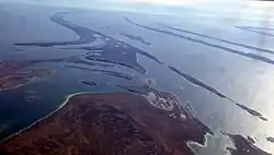
 Flaherty Island from the air, looking south. | |
 Flaherty Island  Flaherty Island | |
| Geography | |
|---|---|
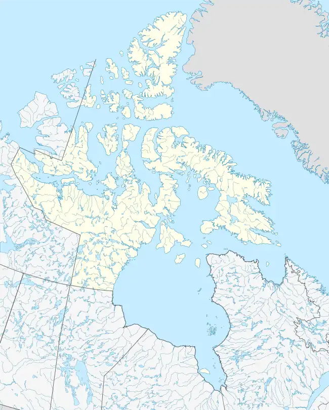
| Location | Hudson Bay |
| Coordinates | 56°14′N 079°17′W / 56.233°N 79.283°W[1] |
| Archipelago | Belcher Islands Arctic Archipelago |
| Length | 7.1 km (4.41 mi) |
| Width | 4.2 km (2.61 mi) |
| Highest elevation | 34 m (112 ft)[3] |
| Administration | |
Canada | |
| Territory | Nunavut |
| Region | Qikiqtaaluk |
| Largest settlement | Sanikiluaq |
| Demographics | |
| Population | 812 |
| Ethnic groups | Inuit |
Flaherty Island is the largest island of the Belcher Islands group in Hudson Bay in Qikiqtaaluk Region, Nunavut, Canada.
The Inuit community of Sanikiluaq is located on its north coast. Sanikiluaq is the southernmost community in Nunavut.
The island is named in honour of visual anthropologist Robert J. Flaherty.[4]
References
- ↑ "Flaherty Island". Geographical Names Data Base. Natural Resources Canada.
- "Flaherty Island". Geographical Names Data Base. Natural Resources Canada.
- ↑ "Flaherty Island". geonames.org. Retrieved 2009-08-04.
- ↑ Christopher, Robert J.; Flaherty, Frances Hubbard; Flaherty, Robert Joseph (2005). Robert and Frances Flaherty: a documentary life, 1883-1922. McGill-Queen's Press. pp. 429. ISBN 0-7735-2876-8.
External links
- Flaherty Island in the Atlas of Canada - Toporama; Natural Resources Canada
This article is issued from Wikipedia. The text is licensed under Creative Commons - Attribution - Sharealike. Additional terms may apply for the media files.