| Fiddle Range | |
|---|---|
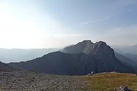 Fiddle Range seen from Roche à Perdrix summit | |
| Highest point | |
| Peak | Fiddle Peak |
| Elevation | 2,243 m (7,359 ft)[1] |
| Listing | Mountains of Alberta |
| Coordinates | 53°10′46″N 117°44′42″W / 53.17944°N 117.74500°W[2] |
| Geography | |
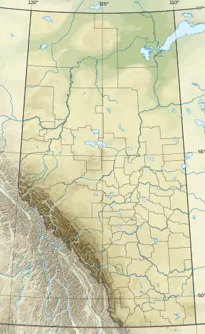 | |
| Country | Canada |
| Province | Alberta |
| Range coordinates | 53°11′57″N 117°46′48″W / 53.19917°N 117.78000°W[3] |
| Parent range | Canadian Rockies |
| Topo map | NTS 83F4 Miette[3] |
The Fiddle Range is a mountain range of the Canadian Rockies located south of Highway 16 on the east border of Jasper National Park, Canada.[3]
The range was so named on account of noises produced by blowing wind.[4]
This range includes the following mountains and peaks:
| Name | Elevation (m/ft) | |
|---|---|---|
| Fiddle Peak | 2,243 | 7,359 |
| Roche à Perdrix | 2,135 | 7,005 |
See also
References
- ↑ "Fiddle Peak". cdnrockiesdatabases.ca. Retrieved 2023-07-10.
- ↑ "Fiddle Peak". Geographical Names Data Base. Natural Resources Canada. Retrieved 2023-07-10.
- 1 2 3 "Fiddle Range". Geographical Names Data Base. Natural Resources Canada. Retrieved 2023-07-10.
- ↑ Place-names of Alberta. Ottawa: Geographic Board of Canada. 1928. p. 51.
This article is issued from Wikipedia. The text is licensed under Creative Commons - Attribution - Sharealike. Additional terms may apply for the media files.