| Doe Run Creek Tributary to Ararat River | |
|---|---|
 Location of Doe Run Creek mouth  Doe Run Creek (Ararat River tributary) (the United States) | |
| Location | |
| Country | United States |
| State | Virginia |
| County | Patrick |
| Physical characteristics | |
| Source | Johnson Creek divide |
| • location | about 2 miles west of Groundhog Mountain peak |
| • coordinates | 36°38′31″N 080°33′14″W / 36.64194°N 80.55389°W[1] |
| • elevation | 2,500 ft (760 m)[2] |
| Mouth | Ararat River |
• location | about 1 mile northwest of The Hollow, Virginia |
• coordinates | 36°35′25″N 080°32′56″W / 36.59028°N 80.54889°W[1] |
• elevation | 1,188 ft (362 m)[2] |
| Length | 3.78 mi (6.08 km)[3] |
| Basin size | 2.63 square miles (6.8 km2)[4] |
| Discharge | |
| • location | Ararat River |
| • average | 4.69 cu ft/s (0.133 m3/s) at mouth with Ararat River[4] |
| Basin features | |
| Progression | Ararat River → Yadkin River → Pee Dee River → Winyah Bay → Atlantic Ocean |
| River system | Yadkin River |
| Tributaries | |
| • left | Mire Branch |
| • right | unnamed tributaries |
| Bridges | Logan Bluff, Youngs View Trail, Green Spring Road, Friends Mission Road |
Doe Run Creek is a 3.73 mi (6.00 km) long 1st order tributary to the Ararat River in Patrick County, Virginia.
Variant names
According to the Geographic Names Information System, it has also been known historically as:[1]
- Doe Run Baptist Church
Course
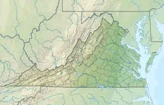
Doe Run Creek rises on the Johnson Creek divide about 2 miles west of the Groundhog Mountain peak in Patrick County. Doe Run Creek then flows south to join the Ararat River about 1 mile northwest of The Hollow, Virginia.[2]
Watershed
Doe Run Creek drains 2.63 square miles (6.8 km2) of area, receives about 50.5 in/year of precipitation, has a wetness index of 307.61, and is about 73% forested.[4]
See also
References
- 1 2 3 "GNIS Detail - Doe Run Creek". geonames.usgs.gov. US Geological Survey. Retrieved 19 September 2020.
- 1 2 3 "Clarks Creek Topo Map in Patrick". TopoZone. Locality, LLC. Retrieved 19 September 2020.
- ↑ "ArcGIS Web Application". epa.maps.arcgis.com. US EPA. Retrieved 19 September 2020.
- 1 2 3 "Doe Run Creek Watershed Report". US EPA Geoviewer. US EPA. Retrieved 19 September 2020.
This article is issued from Wikipedia. The text is licensed under Creative Commons - Attribution - Sharealike. Additional terms may apply for the media files.