| Crooked Creek crater | |
|---|---|
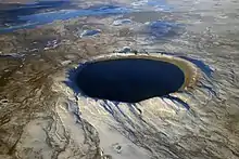
 Faults and other tectonic structures related to the Crooked Creek crater on a shaded relief map | |
| Impact crater/structure | |
| Confidence | Confirmed |
| Diameter | 4.3 mi (7 km) |
| Age | 320 ± 80 Ma (Mississippian) |
| Exposed | Yes |
| Drilled | No |
| Bolide type | see 38th parallel structures |
| Location | |
| Coordinates | 37°50′N 91°23′W / 37.833°N 91.383°W[1] |
| Country | United States |
| State | Missouri |
| District | Crawford County |
 Location of the crater in the United States  Crooked Creek crater (Missouri) | |
| Topo map | USGS Cook Station |
Crooked Creek is an impact crater in Crawford County, Missouri, United States.
It is 4.3 miles (7 km) in diameter and the age is estimated to be 320 ± 80 million years (Mississippian). The crater is exposed to the surface.[1]
This is one of the 38th parallel structures, a series of circular depressions stretching across the central United States, thought to possibly be the result of a serial impact.
See also
References
- 1 2 "Crooked Creek on Earth Impact Database". Archived from the original on 2012-06-05. Retrieved 2011-10-02.
This article is issued from Wikipedia. The text is licensed under Creative Commons - Attribution - Sharealike. Additional terms may apply for the media files.