Crooked Creek, Georgia | |
|---|---|
 Crooked Creek, Georgia | |
| Coordinates: 33°15′42″N 83°16′04″W / 33.26167°N 83.26778°W | |
| Country | United States |
| State | Georgia |
| County | Putnam |
| Area | |
| • Total | 3.83 sq mi (9.93 km2) |
| • Land | 3.23 sq mi (8.37 km2) |
| • Water | 0.60 sq mi (1.56 km2) |
| Elevation | 420 ft (130 m) |
| Population (2020) | |
| • Total | 685 |
| • Density | 212.01/sq mi (81.86/km2) |
| Time zone | UTC-5 (Eastern (EST)) |
| • Summer (DST) | UTC-4 (EDT) |
| ZIP code | 31024[2] |
| Area code(s) | 706 & 762 |
| GNIS feature ID | 2587031[3] |
Crooked Creek is a census-designated place in Putnam County, Georgia, United States. Its population was 685 as of the 2020 census. The community is located on the western bank of the Oconee River.
Demographics
| Census | Pop. | Note | %± |
|---|---|---|---|
| 2020 | 685 | — | |
| U.S. Decennial Census[4] | |||
References
- ↑ "2020 U.S. Gazetteer Files". United States Census Bureau. Retrieved December 18, 2021.
- ↑ "Crooked Creek ZIP Code". zipdatamaps.com. 2023. Retrieved January 12, 2023.
- ↑ "Crooked Creek Census Designated Place". Geographic Names Information System. United States Geological Survey, United States Department of the Interior.
- ↑ "Census of Population and Housing". Census.gov. Retrieved June 4, 2016.
Municipalities and communities of Putnam County, Georgia, United States | ||
|---|---|---|
| City | 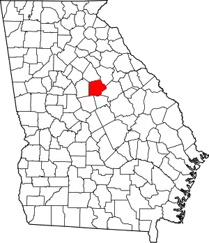 Map of Georgia highlighting Putnam County | |
| CDP | ||
| Unincorporated communities | ||
| Ghost town | ||
This article is issued from Wikipedia. The text is licensed under Creative Commons - Attribution - Sharealike. Additional terms may apply for the media files.