Central George Town | |
|---|---|
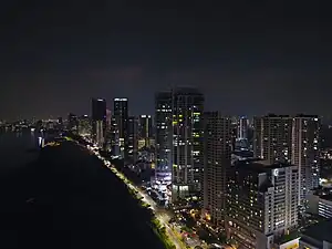 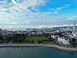 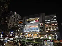  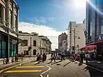  From top, left to right:
| |
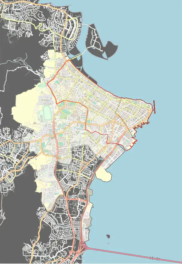
.svg.png.webp) City centre Central George Town is bounded in black within George Town | |
| Coordinates: 5°24′47.019″N 100°19′50.7426″E / 5.41306083°N 100.330761833°E | |
| Country | |
| State | |
| City | |
| Incorporated (city) | 1 January 1957 |
| Government | |
| • Type | City council |
| • Body | Penang Island City Council |
| • Mayor | Rajendran P. Anthony |
| • City Secretary | Cheong Chee Hong |
| Area | |
| • Total | 19 km2 (7 sq mi) |
| Population (2020)[1] | |
| • Total | 158,336 |
| • Density | 8,300/km2 (22,000/sq mi) |
| Postal code | 100xx |
| Area code(s) | +6042 |
| Part of | Melaka and George Town, the Historic Cities of the Straits of Malacca |
| Criteria | Cultural: ii, iii, iv |
| Reference | 1223-002 |
| Inscription | 2008 (32nd Session) |
| Area | 109.38 ha |
| Buffer zone | 150.04 ha |
Central George Town is the city centre of George Town, the capital of the Malaysian state of Penang. It corresponds to the eponymous mukim of George Town, which is mostly identical to the original city limits established when George Town was granted city status in 1957.[2][3]
Encompassing 19 km2 (7.3 sq mi) of the northeastern promontory of Penang Island, the city centre stretches from Gurney Drive in the northwest to The Light Waterfront development in the southeast, encompassing the Central Business District and the 260-acre (110 ha) UNESCO World Heritage Site.[4] It is also home to the seats of the executive and legislative branches of the Penang state government.
History
George Town's modern history dates back to 17 July 1786 when Francis Light first set foot at what is now Fort Cornwallis within the downtown area. Over time, the city expanded from the tip of the northeastern cape of Penang Island, eventually reaching its original city limits when it was granted city status in 1957. However, Jelutong was later carved out of the southernmost corner of the city centre as a separate mukim in 1966.[2]
Prior to the independence of Malaya in 1957, George Town had been conferred city status by Queen Elizabeth II, making it the first city within the new nation. In the post-independence years, George Town remained the largest and only city in Malaya. This continued until 1963 when Singapore was incorporated into the Malaysian federation, displacing George Town as the largest city of the country. However, Singapore's expulsion from Malaysia almost two years later left George Town once again as the sole city in Malaysia until 1974 when Kuala Lumpur was granted city status.
The merger of the George Town City Council with the Penang Island Rural District Council in 1974 sparked a debate over George Town's city status that lasted for decades. While George Town was once again conferred city status in 2015, the city's jurisdiction was expanded to cover the entirety of Penang Island and surrounding islets, far beyond George Town's original city limits.[5] Today, the mukim of George Town is considered the economic and political heart of the city.
Geography
The city centre of George Town encompasses 19 km2 (7.3 sq mi) of the northeastern plains of Penang Island, forming the basin of the Pinang River, the main river system on the island. Aside from the 260-acre (110 ha) UNESCO World Heritage Site which marks the city's old core, the area also includes newer neighborhoods like Karpal Singh Drive and The Light Waterfront. The city centre shares boundaries with Tanjong Tokong to the northwest, Air Itam to the west, and Jelutong and Gelugor to the south.
The city's Central Business District (CBD), an economic corridor that contains much of George Town's financial and services sectors, lies entirely within the city centre.[6] The UNESCO World Heritage Zone that covers the northeastern tip of Penang Island is entirely encompassed by the CBD.
World Heritage
Site
Demographics
| Year | Pop. | ±% |
|---|---|---|
| 1911 | 101,182 | — |
| 1921 | 123,069 | +21.6% |
| 1931 | 149,408 | +21.4% |
| 1947 | 189,068 | +26.5% |
| 1957 | 234,900 | +24.2% |
| 1970 | 269,247 | +14.6% |
| 1980 | 250,578 | −6.9% |
| 1991 | 219,603 | −12.4% |
| 2000 | 180,573 | −17.8% |
| 2010 | 198,298 | +9.8% |
| 2020 | 158,336 | −20.2% |
| Source: [7] | ||
As of 2020, the city centre was home to 158,336 residents, or nearly +1⁄5 of George Town's total population.[8][9] In spite of being the commercial and political heart of Penang however, the city centre has witnessed a decline in population since the late 20th century, owing to the rapid industrialisation and economic growth of the suburbs, coupled with the repeal of the Rent Control Act in 2001.[10][11][12][13] Nonetheless, the city centre remains relatively popular among expatriates within George Town, comprising over 5.3% of the city centre's population in 2010.[14]
In recent years, the state's authorities, under the governance of Pakatan Harapan, have begun undertaking various measures to rejuvenate and rehabilitate the area. This includes exploring the economic synergies between the city centre and Butterworth on the mainland under the 'Penang Bay' concept.[15][16][17]
Transport
Penang Road, Dato Keramat Road, Gurney Drive, Northam Road and Green Lane are some of the centuries-old municipal roads that still serve as major thoroughfares within the city center of George Town. The George Town Inner Ring Road, which comprises Gurney Drive, Jalan Pangkor, Jalan Perak and Jalan Sungai Pinang, forms a loop within the city centre.
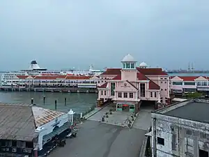
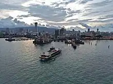
Additionally, the city centre is home to Swettenham Pier, the busiest port-of-call for cruise shipping in Malaysia, and the Raja Tun Uda Ferry Terminal, which provides a ferry service linking the city centre with mainland Seberang Perai.[18]
See also
References
- ↑ "Population and Housing Statistics". Key Findings Population and Housing Census of Malaysia 2020: Pulau Pinang (in Malay and English). Putrajaya: Department of Statistics (Malaysia). 29 May 2022. p. 96. ISBN 9789672535164.
- 1 2 "Kod dan Nama Sempadan Pentadbiran Tanah Unique Parcel Identifier (UPI) Pulau Pinang" (PDF). Ministry of Natural Resources and Environment. 2011.
- ↑ Penang past and present, 1786-1963: a historical account of the City of George Town since 1786. George Town: George Town City Council. 1966.
- ↑ "Melaka and George Town, Historic Cities of the Straits of Malacca". UNESCO World Heritage Centre. UNESCO. Retrieved 26 May 2017.
- ↑ "George Town meliputi 'pulau', jelas Datuk Bandar" (PDF). Buletin Mutiara. 1 May 2015.
- ↑ "Draf Rancangan Tempatan Pulau Pinang (Pulau) 2030 Jilid 1". Penang Island City Council.
- ↑ Usman Yaakob, Tarmiji Masron, Fujimaki Masami. "Ninety Years of Urbanization in Malaysia: A Geographical Investigation of Its Trends and Characteristics" (PDF). Ritsumeikan University.
{{cite journal}}: CS1 maint: multiple names: authors list (link) - ↑ "Population and Housing Statistics". Key Findings Population and Housing Census of Malaysia 2020: Pulau Pinang (in Malay and English). Putrajaya: Department of Statistics (Malaysia). 29 May 2022. p. 96. ISBN 9789672535164.
- ↑ "Map ~ Stats GeoPortal". statsgeo.mycensus.gov.my. Retrieved 15 October 2023.
- ↑ Evelyn Teh (July 2016). "Where the Sea Meets the City is Where the World Meets Penang". Penang Monthly. Archived from the original on 1 December 2017. Retrieved 30 November 2017.
- ↑ "Higher Education in Regional and City Development : State of Penang, Malaysia". OECD.
- ↑ Nancy Duxbury, W.F. Garrett-Petts, David MacLennan (2015). Cultural Mapping as Cultural Inquiry. Routledge. ISBN 9781317588016.
- ↑ Daniel Goh, P. S. (2014). "Between History and Heritage: Post-Colonialism, Globalisation, and the Remaking of Malacca, Penang and Singapore" (PDF). Trans-Regional and -National Studies of Southeast Asia. 2.
- ↑ "Population Distribution by Local Authority Areas and Mukims, 2010 (page 1 & 8)" (PDF). Department of Statistics, Malaysia. Archived from the original (PDF) on 5 February 2015. Retrieved 19 July 2013.
- ↑ "GEORGE TOWN WORLD HERITAGE SITE: A CITY IN TRANSITION Population and Land Use Census 2009—2019" (PDF). Think City. 2021.
- ↑ "PENANG BAY INTERNATIONAL IDEAS COMPETITION: REIMAGINING THE WATERFRONTS OF GEORGE TOWN AND BUTTERWORTH, PENANG, MALAYSIA". Penang state government. 2020.
- ↑ Usman Yaakob, Tarmiji Masron, Fujimaki Masami. "Ninety Years of Urbanization in Malaysia: A Geographical Investigation of Its Trends and Characteristics" (PDF). Ritsumeikan University.
{{cite journal}}: CS1 maint: multiple names: authors list (link) - ↑ "Swettenham Pier surpasses Port Klang as top port of call for cruise ships". www.thesundaily.my. Retrieved 21 December 2017.
Places adjacent to Central George Town, Penang | ||||||||||||||||
|---|---|---|---|---|---|---|---|---|---|---|---|---|---|---|---|---|
| ||||||||||||||||