Breitenbach-Haut-Rhin | |
|---|---|
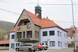 New town hall of Breitenbach | |
.svg.png.webp) Coat of arms | |
Location of Breitenbach-Haut-Rhin | |
 Breitenbach-Haut-Rhin 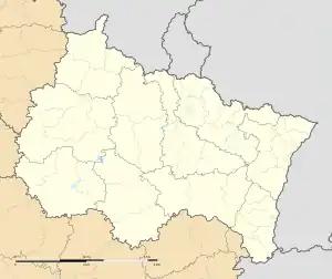 Breitenbach-Haut-Rhin | |
| Coordinates: 48°01′27″N 7°06′05″E / 48.0242°N 7.1014°E | |
| Country | France |
| Region | Grand Est |
| Department | Haut-Rhin |
| Arrondissement | Colmar-Ribeauvillé |
| Canton | Wintzenheim |
| Intercommunality | Vallée de Munster |
| Government | |
| • Mayor (2020–2026) | Monique Hans[1] |
| Area 1 | 9.37 km2 (3.62 sq mi) |
| Population | 819 |
| • Density | 87/km2 (230/sq mi) |
| Time zone | UTC+01:00 (CET) |
| • Summer (DST) | UTC+02:00 (CEST) |
| INSEE/Postal code | 68051 /68380 |
| Elevation | 414–1,165 m (1,358–3,822 ft) (avg. 440 m or 1,440 ft) |
| 1 French Land Register data, which excludes lakes, ponds, glaciers > 1 km2 (0.386 sq mi or 247 acres) and river estuaries. | |
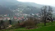
Breitenbach
Breitenbach-Haut-Rhin (German: Breitenbach; Alsatian: Bräitebàch or Bräiteba) is a commune in the Haut-Rhin department in Grand Est in north-eastern France.
Its inhabitants are Breitenbachois. Its official name distinguishes it from Breitenbach, Bas-Rhin.
The place name appears in thirteenth-century documents, and is composed of the words breit ("wide") and bach ("stream"). The valley in which it lies was a possession of the Abbey of Munster until the French Revolution.
See also
References
- ↑ "Répertoire national des élus: les maires". data.gouv.fr, Plateforme ouverte des données publiques françaises (in French). 2 December 2020.
- ↑ "Populations légales 2020". The National Institute of Statistics and Economic Studies. 29 December 2022.
Wikimedia Commons has media related to Breitenbach-Haut-Rhin.
This article is issued from Wikipedia. The text is licensed under Creative Commons - Attribution - Sharealike. Additional terms may apply for the media files.