Breckland District | |
|---|---|
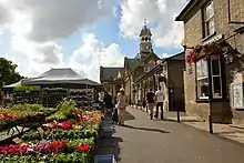
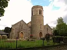
 Dereham, the administrative centre of the district and the second-largest settlement in the district | |
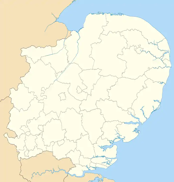
 Breckland shown within Norfolk | |
| Sovereign state | |
| Constituent country | |
| Region | East of England |
| Non-metropolitan county | Norfolk |
| Status | Non-metropolitan district |
| Admin HQ | Dereham |
| Incorporated | 1 April 1974 |
| Government | |
| • Type | Non-metropolitan district council |
| • Body | Breckland District Council |
| • MPs | George Freeman Liz Truss |
| Area | |
| • Total | 1,035.1 km2 (399.7 sq mi) |
| • Rank | 17th (of 296) |
| Population (2021) | |
| • Total | 142,164 |
| • Rank | 158th (of 296) |
| • Density | 140/km2 (360/sq mi) |
| • Ethnicity | 98.5% White |
| Time zone | UTC0 (GMT) |
| • Summer (DST) | UTC+1 (BST) |
| ONS code | 33UB (ONS) E07000143 (GSS) |
| OS grid reference | TG018081 |
Breckland is a local government district in Norfolk, England. Its council is based in Dereham, although the largest town is Thetford. The district also includes the towns of Attleborough, Swaffham and Watton, along with numerous villages and surrounding rural areas.
The district derives its name from the Breckland landscape region, a gorse-covered sandy heath of south Norfolk and north Suffolk. The term "Breckland" dates back to at least the 13th century.
The neighbouring districts are King's Lynn and West Norfolk, North Norfolk, Broadland, South Norfolk, Mid Suffolk and West Suffolk.
History
The district was created on 1 April 1974 under the Local Government Act 1972, covering six former districts which were all abolished at the same time:[1]
- East Dereham Urban District
- Mitford and Launditch Rural District
- Swaffham Rural District
- Swaffham Urban District
- Thetford Municipal Borough
- Wayland Rural District
The new district was named Breckland after the distinctive landscape which covers parts of the area.[2] The name was chosen following a competition organised by the outgoing authorities which invited local schools, organisations and individuals to put forward suggested names.[3]
Politics
The Council consists of 49 Councillors elected every four years, the last election being May 2019.
It is currently controlled by the Conservative Party who won 37 of the 49 seats on the council at the last election.
Leader of the Council
The Leader since May 2019 is Sam Chapman-Allen (Conservative) (Forest Ward).
The Deputy Leader since May 2023 is Sarah Suggitt (Conservative) (All Saints and Wayland Ward)
Chairman of the Council
The Chairman is Peter Wilkinson (Nar Valley Ward)
The Vice-Chairman is Terry Jermey
Past Chairmen of the Council
- 2019-2021 Lynda Turner (Shipdham Ward)
- 2018-2019 Richard Duffield (Lincoln Ward)
- 2017-2018 Kate Millbank (Dereham Tofwood Ward)
- 2016-2017 Bill Borrett (Upper Wensum Ward)
- 2015-2016 Gordon Bambridge (Upper Wensum Ward)
- 2014-2015 Robert Kybird (Thetford Guildhall Ward)
- 2013-2014 Paul Claussen (Two Rivers Ward)
- 2012-2013 Robin Goreham (Dereham Central Ward)
- 2011-2012 Nigel Wilkin (Necton Ward)
Election Results
For the results of the last election to the council click on this link, Breckland District Council election 2019.
For further information on previous elections click on link, Breckland District Council - Elections
UK Youth Parliament
Although the UK Youth Parliament is an apolitical organisation, the elections are run in a way similar to that of the Local Elections. The votes come from 11 to 18 year olds and are combined to make the decision of the next, 2 year Member of Youth Parliament. The elections are run at different times across the country with Breckland's typically being in early Spring and bi-annually.
The current Member of Youth Parliament for Breckland is Jake Dorman MYP.[4][5][6]
Council parishes
The council is entirely parished, and is made up of 113 civil parishes. At the time of the 2001 census, the district had an area of 1,305 km2 (504 sq mi), with a population of 121,418 in 50,715 households.[7]
The council contains the following civil parishes:
- Ashill, Attleborough
- Banham, Bawdeswell, Beachamwell, Beeston with Bittering,[8] Beetley, Besthorpe, Billingford, Bintree, Blo' Norton, Bradenham, Brettenham, Bridgham, Brisley, Bylaugh
- Carbrooke, Caston, Cockley Cley, Colkirk, Cranwich, Cranworth, Croxton
- Didlington, Dereham
- East Tuddenham, Elsing
- Foulden, Foxley, Fransham
- Garboldisham, Garvestone, Gateley, Gooderstone, Great Cressingham, Great Dunham, Great Ellingham, Great Hockham, Gressenhall, Griston, Guist
- Hardingham, Harling, Hilborough, Hockering, Hoe, Holme Hale, Horningtoft
- Ickburgh
- Kempstone, Kenninghall, Kilverstone
- Lexham, Litcham, Little Cressingham, Little Dunham, Little Ellingham, Longham, Lynford, Lyng
- Mattishall, Merton, Mileham, Mundford
- Narborough, Narford, Necton, New Buckenham, Newton by Castle Acre, North Elmham, North Lopham, North Pickenham, North Tuddenham
- Old Buckenham, Ovington, Oxborough
- Quidenham
- Riddlesworth, Rocklands, Rockland St Peter, Roudham and Larling, Rougham
- Saham Toney, Scarning, Scoulton, Shipdham, Shropham, Snetterton, South Acre, South Lopham, South Pickenham, Sparham, Sporle with Palgrave, Stanfield, Stanford, Stow Bedon, Sturston, Swaffham, Swanton Morley,
- Thetford, Thompson, Tittleshall, Tottington, Twyford
- Watton, Weasenham All Saints, Weasenham St. Peter, Weeting-with-Broomhill, Wellingham, Wendling, Whinburgh and Westfield, Whissonsett, Wretham
- Yaxham
References
- ↑ "The English Non-metropolitan District (Definition) Order 1972", legislation.gov.uk, The National Archives, SI 1972/2039, retrieved 17 November 2023
- ↑ "The English Non-metropolitan Districts (Names) Order 1973", legislation.gov.uk, The National Archives, SI 1973/551, retrieved 31 May 2023
- ↑ "Breckland may be name of new council". Lynn Advertiser. 8 December 1972. p. 8. Retrieved 3 December 2023.
- ↑ "Members of Youth Parliament - Norfolk County Council". www.norfolk.gov.uk.
- ↑ "Your Norfolk -". yournorfolk.norfolkpublications.org.uk.
- ↑ Cope, Lauren (30 March 2018). "Norfolk's four new Members of Youth Parliament are announced". Eastern Daily Press.
- ↑ Office for National Statistics & Norfolk County Council (2001). Census population and household counts for unparished urban areas and all parishes. Retrieved 2 December 2005.
- ↑ Imossi, R. (1987-06-01). "Bnldag Vax Gmail". doi:10.2172/1157450. OSTI 1157450.
{{cite journal}}: Cite journal requires|journal=(help)
External links
- Diss Express - website of local newspaper covering part of district