Berthelming | |
|---|---|
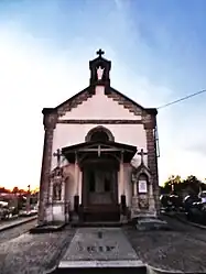 The cemetery chapel in Berthelming | |
.svg.png.webp) Coat of arms | |
Location of Berthelming | |
 Berthelming 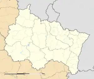 Berthelming | |
| Coordinates: 48°49′01″N 7°00′23″E / 48.8169°N 7.0064°E | |
| Country | France |
| Region | Grand Est |
| Department | Moselle |
| Arrondissement | Sarrebourg-Château-Salins |
| Canton | Sarrebourg |
| Government | |
| • Mayor (2020–2026) | Claude Erhard[1] |
| Area 1 | 10.67 km2 (4.12 sq mi) |
| Population | 512 |
| • Density | 48/km2 (120/sq mi) |
| Time zone | UTC+01:00 (CET) |
| • Summer (DST) | UTC+02:00 (CEST) |
| INSEE/Postal code | 57066 /57930 |
| Elevation | 231–282 m (758–925 ft) (avg. 250 m or 820 ft) |
| 1 French Land Register data, which excludes lakes, ponds, glaciers > 1 km2 (0.386 sq mi or 247 acres) and river estuaries. | |
Berthelming (French pronunciation: [bɛʁtəlmɛ̃]; German: Berthelmingen) is a commune in the Moselle department in Grand Est in northeastern France.
History
The village was part of the seigneury of Fénétrange-Schwanhals.
The commune was destroyed during the Thirty Years' War.
The Reformation from 1560 to 1685 also had an impact on Berthelming.
Population
| Year | Pop. | ±% |
|---|---|---|
| 1962 | 669 | — |
| 1968 | 587 | −12.3% |
| 1975 | 556 | −5.3% |
| 1982 | 568 | +2.2% |
| 1990 | 501 | −11.8% |
| 1999 | 520 | +3.8% |
| 2006 | 526 | +1.2% |
| 2009 | 514 | −2.3% |
Cultural heritage and architecture
The village houses the remains of a Gallo-Roman villa.
A fortified house from the medieval period is still visible nowadays.
See also
References
- ↑ "Répertoire national des élus: les maires" (in French). data.gouv.fr, Plateforme ouverte des données publiques françaises. 13 September 2022.
- ↑ "Populations légales 2020". The National Institute of Statistics and Economic Studies. 29 December 2022.
External links
 Media related to Berthelming at Wikimedia Commons
This article is issued from Wikipedia. The text is licensed under Creative Commons - Attribution - Sharealike. Additional terms may apply for the media files.