Bara, Punjab
ਬਾੜਾ, ਪੰਜਾਬ | |
|---|---|
An Archeological Site of Village Bara | |
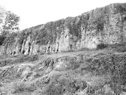 A view of an archeological site | |
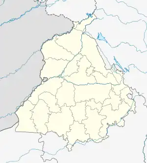 Bara, Punjab Location in Punjab, India 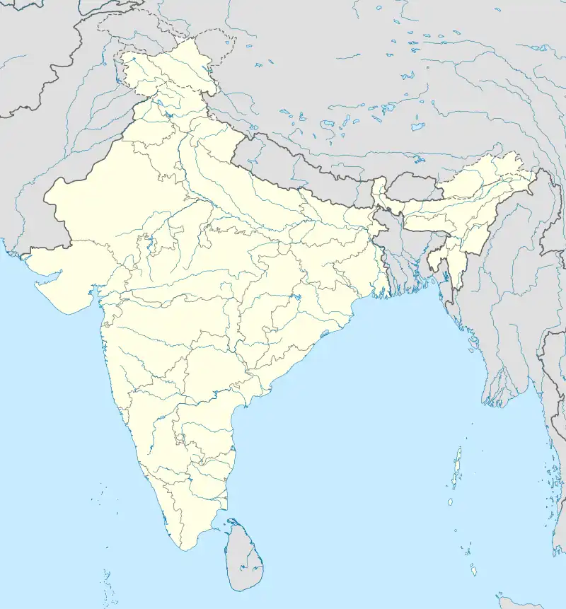 Bara, Punjab Bara, Punjab (India) | |
| Coordinates: 30°55′00″N 76°31′15″E / 30.9167°N 76.5208°E | |
| Country | |
| State | Punjab |
| District | Rupnagar |
| Established | 19th Century (2000 BCE) |
| Government | |
| • Type | Sarpanch - Village Panchayat |
| • Body | Village Panchayat |
| Area | |
| • Total | 0.94 km2 (0.36 sq mi) |
| • Rank | 175 |
| Elevation | 277 m (909 ft) |
| Population | |
| • Total | 512 |
| • Density | 540/km2 (1,400/sq mi) |
| Languages | |
| • Official | Punjabi |
| Time zone | UTC+5:30 (IST) |
| Telephone Code | +91-1881 |
| Vehicle registration | PB 12 & PB 71 |
| Nearest Cities | Rupnagar, Chamkaur Sahib, Morinda |
| Lok Sabha Constituency | Anandpur Sahib (Sl. Number : 49) |
| Vidhan Sabha Constituency | Chamkaur Sahib (Sl. Number : 51) |
| Civic Agency | Village Panchayat |
| Climate | Extreme hot in summers Extreme cold in winters (Köppen) |
| Census Village Number Codes | Village Code : 038691 Panchayat Code : 100 |
Bara is a village in Rupnagar District in Punjab, India. The village has mainly two Jatt Sikh surnames Chakkal and Heer and lies on the Rupnagar-Morinda Road at the left bank of a seasonal monsoon rivulet called Budki Nadi, about four kilometers south-west of the city Ropar and 40 km (25 mi) northeast of Chandigarh on National Highway 205 (India) (NH-205). [1] Bara is the site of significant archeological excavations connected with the Indus Valley civilization.[2] It has some evidence of being home to a culture (sometimes called Baran Culture) that was a pre-Harappan strand of the Indus Valley Civilization.[2] Baran and Harappan cultures may have intertwined and coexisted in some places, such as Kotla Nihang Khan, also in modern-day Punjab.[3]
See also
- Kotla Nihang Khan
- Bara culture or Baran Culture
- Siswal
- Chamkaur Sahib
- Chandigarh - Tri-city
- Kurali
- Mohali
References
- ↑ K.D. Bajpai; Rasesh Jamindar; P. K. Trivedi; Ramanlal Nagarji Mehta (2000), Gleanings of Indian archaeology, history, and culture, Publication Scheme, 2000, ISBN 978-81-86782-64-4,
... Bara lies on the left bank of a monsoon rivulet known as Budki Nadi and is four kilometers southwest of Rupar. It is more known for Bara culture than the Mature phase of Harappa culture ...
- 1 2 Romila Thapar (1978), Ancient Indian Social History: Some Interpretations, Orient Blackswan, 1978, ISBN 978-81-250-0808-8,
... there appears to be a continuity of pre-Harappan cultures into the second millennium B.C. at sites in the Sutlej valley and the upper Saraswati (e.g. Bara and Siswal A) ...
- ↑ Shadaksharappa Settar; Ravi Korisettar (1 January 2002), Indian Archaeology in Retrospect: Prehistory, archaeology of South Asia, Indian Council of Historical Research, 2002, ISBN 978-81-7304-319-2,
... The mound at Kotla Nihang Khan is divided into two sectors: eastern and western. The eastern sector mainly has Urban Harappan pottery like the dish-on-stand, goblets with pointed base, shallow flat dish with flaring sides ... The western part has Urban Harappan elements mixed with Bara Ware from the lower levels. Sharma (1982: 141) thinks that ... initially, in Phase I, the Harappans occupied the eastern area, but with the advent of the Barans ...
Bibliography
- Excavation sites in Punjab Archaeological Survey of India