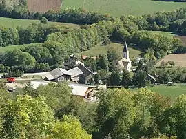
Bénévent-et-Charbillac | |
|---|---|
Part of Saint-Bonnet-en-Champsaur | |
 | |
 Coat of arms | |
Location of Bénévent-et-Charbillac | |
 Bénévent-et-Charbillac 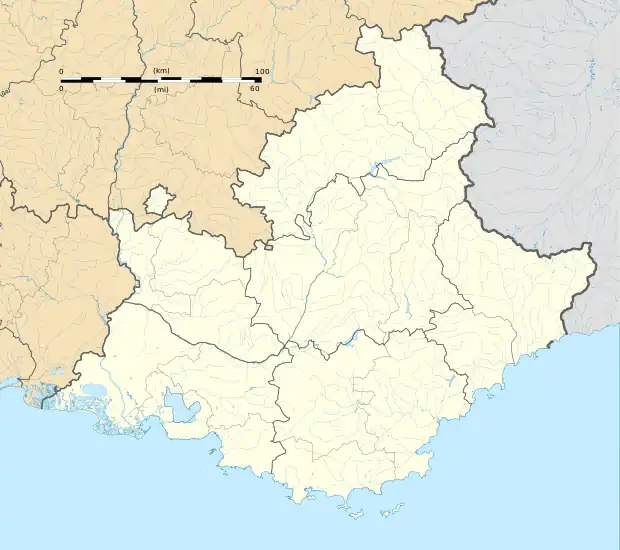 Bénévent-et-Charbillac | |
| Coordinates: 44°41′54″N 6°05′12″E / 44.6983°N 6.0867°E | |
| Country | France |
| Region | Provence-Alpes-Côte d'Azur |
| Department | Hautes-Alpes |
| Arrondissement | Gap |
| Canton | Saint-Bonnet-en-Champsaur |
| Commune | Saint-Bonnet-en-Champsaur |
| Area 1 | 12.15 km2 (4.69 sq mi) |
| Population (2019)[1] | 289 |
| • Density | 24/km2 (62/sq mi) |
| Time zone | UTC+01:00 (CET) |
| • Summer (DST) | UTC+02:00 (CEST) |
| Postal code | 05500 |
| Elevation | 923–2,058 m (3,028–6,752 ft) (avg. 1,120 m or 3,670 ft) |
| 1 French Land Register data, which excludes lakes, ponds, glaciers > 1 km2 (0.386 sq mi or 247 acres) and river estuaries. | |
Bénévent-et-Charbillac (Vivaro-Alpine: Benevent e Charbilhac) is a former commune in the Hautes-Alpes department in southeastern France. Since 2013, it is part of the commune Saint-Bonnet-en-Champsaur.
Population
| Year | Pop. | ±% |
|---|---|---|
| 1962 | 206 | — |
| 1968 | 223 | +8.3% |
| 1975 | 214 | −4.0% |
| 1982 | 221 | +3.3% |
| 1990 | 221 | +0.0% |
| 1999 | 260 | +17.6% |
| 2008 | 280 | +7.7% |
See also
References
Wikimedia Commons has media related to Bénévent-et-Charbillac.
This article is issued from Wikipedia. The text is licensed under Creative Commons - Attribution - Sharealike. Additional terms may apply for the media files.