Arani | |
|---|---|
Suburb | |
 Arani Located just outside Chennai Metropolitan area  Arani Arani (India) | |
| Coordinates: 13°19′59″N 80°05′06″E / 13.3330°N 80.0849°E | |
| Country | |
| State | |
| District | Thiruvallur |
| Talukas | Ponneri Taluk |
| Government | |
| • Type | First Grade Town Panchayat |
| • Body | Arani Town Panchayat |
| Elevation | 7 m (23 ft) |
| Languages | |
| • Official | Tamil |
| Time zone | UTC+5:30 (IST) |
| PIN | 601101 |
| Telephone code | 044 |
| Vehicle registration | TN-18 |
| Planning agency | DTCP |
| Parliamentary constituency | Thiruvallur |
| Assembly constituency | Ponneri |
Arani (Tamil: ஆரணி) is a residential area and suburb of Chennai, India, located on the banks of the Arani river.
Surroundings
Places adjacent to Arani | ||||||||||||||||
|---|---|---|---|---|---|---|---|---|---|---|---|---|---|---|---|---|
| ||||||||||||||||
References
| District Headquarters | 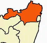 | |
|---|---|---|
| Country | ||
| State | ||
| Region | ||
| Revenue Divisions | ||
| Taluks | ||
| Revenue blocks | ||
| Municipal Corporation | ||
| Municipalities | ||
| Special Grade Town Panchayats | ||
| Town Panchayats | ||
| History | ||
| Places of interest |
| |
| Universities |
| |
This article is issued from Wikipedia. The text is licensed under Creative Commons - Attribution - Sharealike. Additional terms may apply for the media files.