Annecy - Haute-Savoie - Mont Blanc Airport Aéroport Annecy Haute-Savoie Mont Blanc | |||||||||||
|---|---|---|---|---|---|---|---|---|---|---|---|
| Summary | |||||||||||
| Airport type | Public | ||||||||||
| Operator | CCI de Haute Savoie | ||||||||||
| Serves | Annecy, France | ||||||||||
| Location | Meythet, France | ||||||||||
| Elevation AMSL | 1,521 ft / 464 m | ||||||||||
| Coordinates | 45°55′51″N 006°06′23″E / 45.93083°N 6.10639°E | ||||||||||
| Website | annecy | ||||||||||
| Maps | |||||||||||
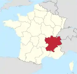 Location of the Rhône-Alpes region in France | |||||||||||
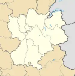 LFLP Location of airport in the Rhône-Alpes region | |||||||||||
| Runways | |||||||||||
| |||||||||||
Source: French AIP[1] | |||||||||||
Annecy – Haute-Savoie – Mont Blanc Airport or Aéroport Annecy Haute-Savoie Mont Blanc (IATA: NCY, ICAO: LFLP), also known as Aéroport d'Annecy - Meythet, is an airport located 3.5 km northwest of Annecy,[1] between Meythet and Metz-Tessy, all communes of the Haute-Savoie département in the Rhône-Alpes région of France.
Airlines and destinations
No destinations served at present.
Statistics
Annual passenger traffic at NCY airport.
See Wikidata query.
References
- 1 2 LFLP – Annecy Meythet. AIP from French Service d'information aéronautique, effective 2 November 2023.
External links
- Aéroport Annecy Haute-Savoie Mont Blanc Archived 2009-06-11 at the Wayback Machine (official site) (in French)
- Aéroport d'Annecy - Haute Savoie (Union des Aéroports Français) (in French)
- Current weather for LFLP at NOAA/NWS
- Accident history for NCY at Aviation Safety Network
This article is issued from Wikipedia. The text is licensed under Creative Commons - Attribution - Sharealike. Additional terms may apply for the media files.