Ambinanindrano | |
|---|---|
 Ambinanindrano | |
 Ambinanindrano Location in Madagascar | |
| Coordinates: 21°05′S 47°57′E / 21.083°S 47.950°E | |
| Country | |
| Region | Amoron'i Mania |
| District | Ambositra |
| Area | |
| • Total | 400 km2 (200 sq mi) |
| Elevation | 678 m (2,224 ft) |
| Population (2019)Census | |
| • Total | 21,364 |
| Time zone | UTC3 (EAT) |
Ambinanindrano is a rural municipality in Madagascar. It belongs to the district of Ambositra, which is a part of Amoron'i Mania Region. The population of the municipality had been 21,364 in 2019.
It is situated at 60 km from Ambositra. It is a main region of sugar cane plantations of the region, rhum is its main product. It is linked to Ambositra by the unpaved Provincial Road 3F, that is in a very bad state of conversation.
Primary and junior level secondary education are available in town. The majority 90% of the population of the commune are farmers. The most important crop is sugarcane, while other important products are beans, cassava and rice. Services provide employment for 10% of the population.[3]
References
- ↑ Production d’éthanol combustible
- ↑ Estimated based on DEM data from Shuttle Radar Topography Mission
- ↑ "ILO census data". Cornell University. 2002. Retrieved 2008-05-13.
Capital: Ambositra | ||
| Ambatofinandrahana (9) - 304 | 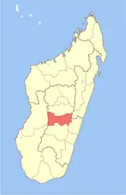 | |
| Ambositra (21) - 306 |
| |
| Fandriana (13) - 308 | ||
| Manandriana (10) - 323 | ||
4 districts; 53 communes | ||
20°41′S 47°34′E / 20.683°S 47.567°E