Altoona, Ohio | |
|---|---|
 Buildings on the northern side of Ohio State Route 93 on the western side of Altoona | |
 Altoona, Ohio Location of Altoona, Ohio | |
| Coordinates: 39°06′48″N 82°35′12″W / 39.11333°N 82.58667°W | |
| Country | United States |
| State | Ohio |
| Counties | Jackson |
| Elevation | 732 ft (223 m) |
| Time zone | UTC-5 (Eastern (EST)) |
| • Summer (DST) | UTC-4 (EDT) |
| ZIP code | 45692 |
| Area code | 740 |
| GNIS feature ID | 1062627[1] |
Altoona is an unincorporated community in Coal Township, Jackson County, Ohio, United States. It is located east of Coalton on Ohio State Route 93.[2][3]
References
- 1 2 "US Board on Geographic Names". United States Geological Survey. 2007-10-25. Retrieved 2019-12-29.
- ↑ U.S. Geological Survey Geographic Names Information System: Altoona, Ohio
- ↑ Rand McNally. The Road Atlas '06. Chicago: Rand McNally, 2006, 78.
Municipalities and communities of Jackson County, Ohio, United States | ||
|---|---|---|
| Cities | 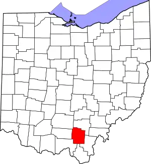 Map of Ohio highlighting Jackson County | |
| Villages | ||
| Townships | ||
| Unincorporated communities |
| |
This article is issued from Wikipedia. The text is licensed under Creative Commons - Attribution - Sharealike. Additional terms may apply for the media files.