| Allen Creek Tributary to Banister River | |
|---|---|
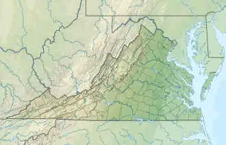 Location of Allen Creek mouth  Allen Creek (Banister River tributary) (the United States) | |
| Location | |
| Country | United States |
| State | Virginia |
| County | Pittsylvania |
| Physical characteristics | |
| Source | unnamed tributary to Straightstone Creek divide |
| • location | about 1 mile southeast of Straightstone, Virginia |
| • coordinates | 37°00′18″N 079°07′55″W / 37.00500°N 79.13194°W[1] |
| • elevation | 590 ft (180 m)[2] |
| Mouth | |
• location | about 1 mile southwest of Hermosa, Virginia |
• coordinates | 36°55′49″N 079°08′34″W / 36.93028°N 79.14278°W[1] |
• elevation | 393 ft (120 m)[3] |
| Length | 5.47 mi (8.80 km)[4] |
| Basin size | 17.08 square miles (44.2 km2)[5] |
| Discharge | |
| • location | Banister River |
| • average | 20.81 cu ft/s (0.589 m3/s) at mouth with Banister River[5] |
| Basin features | |
| Progression | Banister River → Dan River → Roanoke River → Albemarle Sound → Pamlico Sound → Atlantic Ocean |
| River system | Roanoke River |
| Tributaries | |
| • left | Peters Creek |
| • right | Blacks Creek |
| Bridges | Allen Creek Road, VA 40, Hermosa Road |
Allen Creek is a 5.47 mi (8.80 km) long 3rd order tributary to the Banister River in Pittsylvania County, Virginia.
Course
Allen Creek rises 2 miles southeast of Straightstone, Virginia in Pittsylvania County and then flows south-southwest to join the Banister River about 1 miles southwest of Hermosa.[3]
Watershed
Allen Creek drains 17.08 square miles (44.2 km2) of area, receives about 45.2 in/year of precipitation, has a wetness index of 394.34, and is about 59% forested.[5]
See also
References
- 1 2 "GNIS Detail - Allen Creek". geonames.usgs.gov. US Geological Survey. Retrieved 5 August 2021.
- ↑ "Get Maps". USGS Topoview. US Geological Survey. Retrieved 5 August 2021.
- 1 2 "Get Maps". USGS Topoview. US Geological Survey. Retrieved 5 August 2021.
- ↑ "ArcGIS Web Application". epa.maps.arcgis.com. US EPA. Retrieved 5 August 2021.
- 1 2 3 "Allen Creek Watershed Report". US EPA Geoviewer. US EPA. Retrieved 5 August 2021.
This article is issued from Wikipedia. The text is licensed under Creative Commons - Attribution - Sharealike. Additional terms may apply for the media files.