Alchesay Flat, Arizona | |
|---|---|
Physical feature | |
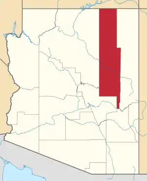
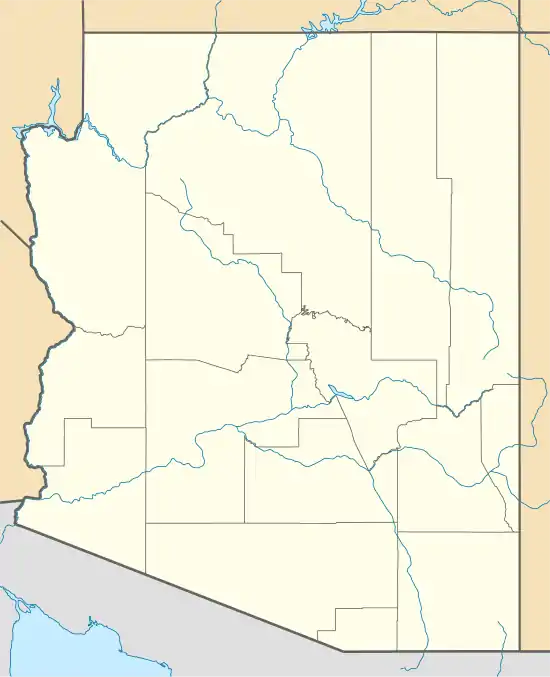 Alchesay Flat, Arizona Location of Alchesay Flat in Arizona | |
| Coordinates: 33°55′56″N 109°56′22″W / 33.93222°N 109.93944°W | |
| Country | United States |
| State | Arizona |
| County | Navajo |
| Elevation | 5,774 ft (1,760 m) |
| Time zone | UTC-7 (Mountain (MST)) |
| • Summer (DST) | UTC-7 (MST) |
| ZIP codes | 85935 |
| Area code | 928 |
| GNIS feature ID | 570 |
Alchesay Flat is a physical feature, named flat, located approximately 7 mi (11 km) north of Whiteriver along Arizona State Route 73 in Navajo County, Arizona. It has an estimated elevation of 5,774 feet (1,760 m) above sea level.
It is located on the Fort Apache Indian Reservation,[2] and is apparently named for Chief Alchesay of the White Mountain Apache tribe, who is buried there.[3][4]
From 1959 to 1972 the Alchesay National Fish Hatchery operated there, before it combined with the nearby Williams hatchery.[5]
References
- ↑ "Feature Detail Report for: Alchesay Flat". Geographic Names Information System. United States Geological Survey, United States Department of the Interior.
- ↑ "Sinone Norman Tortice Sr". Arizona Republic. 17 September 1985. p. 17.
- ↑ "Feature Detail Report for: Chief Alchesay Baha Grave". Geographic Names Information System. United States Geological Survey, United States Department of the Interior.
- ↑ (U.S.), Geological Survey; Names, United States Board on Geographic (1987). The National gazetteer of the United States of America: Arizona 1986. U.S. G.P.O. pp. 1438–.
- ↑ "Alchesay-Williams Creek NFH Complex". US Fish and Wildlife Service.
This article is issued from Wikipedia. The text is licensed under Creative Commons - Attribution - Sharealike. Additional terms may apply for the media files.