| Aka River Akagawa | |
|---|---|
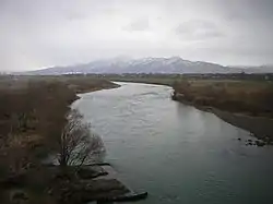 Aka River flowing through the city of Tsuruoka | |
| Etymology | Red River |
| Native name | 赤川 (Japanese) |
| Location | |
| Country | Japan |
| State | Honshu |
| Region | Yamagata |
| Physical characteristics | |
| Source | Mount Itoh |
| • elevation | 1,771 m (5,810 ft) |
| Mouth | Sea of Japan |
• coordinates | 38°50′50″N 139°47′03″E / 38.8471°N 139.7841°E |
| Length | 70 km (43 mi) |
| Basin size | 857 km2 (331 sq mi) |
Aka River (赤川, Akagawa, lit. 'red river') is a river in Yamagata Prefecture, Japan. It flows into the Sea of Japan.[1]
Soccer fields on Akagawa riverbed
There are football fields on Akagawa riverbed in Tsuruoka, and they were NEC Yamagata SC's practice grounds.[2][3]
References
- ↑ 日本の川 - 東北 - 赤川 - 国土交通省水管理・国土保全局. mlit.go.jp (in Japanese). Retrieved 31 March 2021.
- ↑ @kamikaze_monte (4 May 2017). "モンテディオ山形のもうひとつの聖地と言っても良い鶴岡市 赤川グランド(現在はあまり使われてないので荒れてます)このグランドを主に、モンテの前身であるNEC山形鶴岡工場のサッカー同好会が鶴岡市社会人リーグを戦っていたんだよね!" (Tweet) – via Twitter.
- ↑ "赤川河川緑地の紹介". www.city.tsuruoka.lg.jp.
This article is issued from Wikipedia. The text is licensed under Creative Commons - Attribution - Sharealike. Additional terms may apply for the media files.