| Žďárské vrchy | |
|---|---|
 | |
| Highest point | |
| Peak | Devět skal |
| Elevation | 836 m (2,743 ft) |
| Listing | |
| Dimensions | |
| Area | 485.78 sq km |
| Geography | |
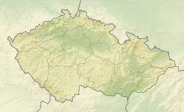 Žďárské vrchy, Czech Republic | |
| Country | Czech Republic |
| Range coordinates | 49°40′14″N 16°01′56″E / 49.670556°N 16.032222°E |
| Parent range | Bohemian Massif |
Žďárské vrchy (German: Saarer Bergland) is a mountain range in the Czech Republic. It is located in the northwest part of Upper Svratka Highlands which is part of Bohemian-Moravian Highlands and has an area of 485.78 km2. The highest peak of Žďárké vrchy is Devět skal (836 m).[1] Other significant peaks are Křovina (829,7 m), Křivý javor (823,5 m), Kopeček (821,7 m) or Pasecká skála (818,6 m).[2]
Žďárské vrchy is a source of the Sázava[3] and Svratka[4] rivers.
The forest cover comprises mostly spruces, mixed by beeches, firs, larches and pines.[1]
References
- 1 2 Zeměpisný lexikon ČR. Hory a nížiny (in Czech). Jaromír Demek, Peter Mackovčin, Břetislav Balatka (2nd ed.). Brno: AOPK ČR. 2006. pp. 257–258. ISBN 80-86064-99-9. OCLC 320480762.
{{cite book}}: CS1 maint: others (link) - ↑ Cachová, Iveta; Smolová, Irena (2014). Krajina CHKO Žďárské vrchy ve výuce geografie na základních a středních školách (PDF) (in Czech). Olomouc: Palacký University Olomouc.
- ↑ "Základní charakteristky toku SÁZAVA a jeho povodí". VÚV T.G.Masaryka – Oddělení GIS (in Czech).
- ↑ "Základní charakteristiky toku SVRATKA a jeho povodí". VÚV T.G.Masaryka – Oddělení GIS (in Czech).
This article is issued from Wikipedia. The text is licensed under Creative Commons - Attribution - Sharealike. Additional terms may apply for the media files.