Čejč | |
|---|---|
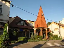 Municipal office | |
 Flag  Coat of arms | |
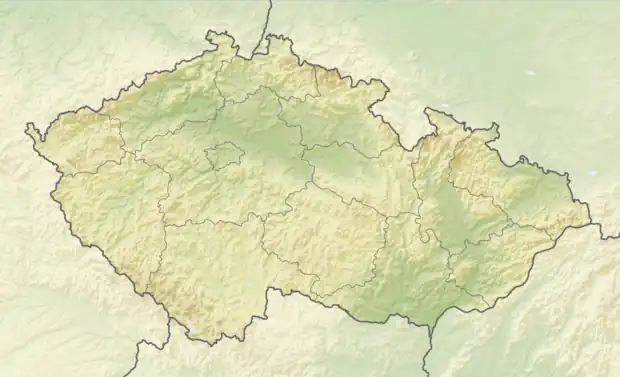 Čejč Location in the Czech Republic | |
| Coordinates: 48°56′48″N 16°57′54″E / 48.94667°N 16.96500°E | |
| Country | |
| Region | South Moravian |
| District | Hodonín |
| First mentioned | 1222 |
| Area | |
| • Total | 13.29 km2 (5.13 sq mi) |
| Elevation | 183 m (600 ft) |
| Population (2023-01-01)[1] | |
| • Total | 1,269 |
| • Density | 95/km2 (250/sq mi) |
| Time zone | UTC+1 (CET) |
| • Summer (DST) | UTC+2 (CEST) |
| Postal code | 696 14 |
| Website | www |
Čejč (German: Czejtsch, Tscheitsch) is a municipality and village in Hodonín District in the South Moravian Region of the Czech Republic. It has about 1,300 inhabitants.
Čejč lies approximately 17 kilometres (11 mi) north-west of Hodonín, 38 km (24 mi) south-east of Brno, and 224 km (139 mi) south-east of Prague.
Etymology
The original form of the name of the village was Čaječ and was derived from the personal name Čajek, which was a domestic form of some name containing -čaj (Dobročaj, Bolečaj, etc., it is the base of the verb čajati – "to wait, to expect"). The meaning of the local name was "Čajek's property". From the indirect cases (Čajče, Čajči), a new form Čajč was created, changed by the regular phonetic change ča > če to Čejč, which is already in the oldest documents (but the form Čajč was recorded as early as 1368 and preserved in the local dialect).[2]
References
- ↑ "Population of Municipalities – 1 January 2023". Czech Statistical Office. 2023-05-23.
- ↑ Hosák, Šrámek: Místní jména na Moravě a ve Slezsku I, Prague 1970, page.155, 156.