Native name: Île Australia | |
|---|---|
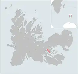 The Île Australia is highlighted on this Kerguelen Islands map. | |
| Geography | |
| Location | Indian Ocean |
| Coordinates | 49°27′S 69°50′E / 49.450°S 69.833°E |
| Archipelago | Îles Kerguelen |
| Area | 37 km2 (14 sq mi) |
| Length | 10 km (6 mi)[1] |
| Width | 3 km (1.9 mi)[1] |
| Coastline | 32 km (19.9 mi)[1] |
| Highest elevation | 145 m (476 ft).[1] |
| Highest point | Le stack de Tome |
| Administration | |
| District | Îles Kerguelen |
| Demographics | |
| Population | 0 |
Île Australia is one of the Kerguelen Islands situated in the Golfe du Morbihan near the coast of Grande Terre, the principal island.
It is around 10 km long and 3 km wide. The highest spot is Le stack de Tome at 145 metres.
References
This article is issued from Wikipedia. The text is licensed under Creative Commons - Attribution - Sharealike. Additional terms may apply for the media files.