Tornau | |
|---|---|
Location of Tornau | |
 Tornau 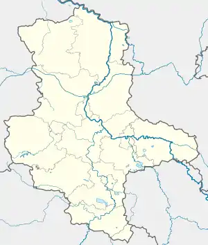 Tornau | |
| Coordinates: 51°38′N 12°36′E / 51.633°N 12.600°E | |
| Country | Germany |
| State | Saxony-Anhalt |
| District | Wittenberg |
| Town | Gräfenhainichen |
| Area | |
| • Total | 25.81 km2 (9.97 sq mi) |
| Elevation | 118 m (387 ft) |
| Population (2009-12-31) | |
| • Total | 559 |
| • Density | 22/km2 (56/sq mi) |
| Time zone | UTC+01:00 (CET) |
| • Summer (DST) | UTC+02:00 (CEST) |
| Postal codes | 06774 |
| Dialling codes | 034243 |
| Vehicle registration | WB |
| Website | www.tornau-heidedorf.de |
Tornau is a village and a former municipality in Wittenberg district in Saxony-Anhalt, Germany. Since 1 January 2011, it is part of the town Gräfenhainichen. It was part of the administrative community (Verwaltungsgemeinschaft) of Tor zur Dübener Heide.
Geography
Location
Tornau lies about 5 km north of Bad Düben in the Düben Heath Nature Park.
Neighbouring municipalities
- Söllichau (Wittenberg district)
- Bad Düben (Delitzsch district, Saxony)
- Schwemsal (Anhalt-Bitterfeld district)
- Schköna (Wittenberg district)
Economy and transportation
Federal Highway (Bundesstraße) B 2 between Leipzig and Wittenberg runs straight through the municipality, while State Highway (Landesstraße) 130, which connects to the B 2 and the B 183/107, crosses the municipal area.
References
External links
This article is issued from Wikipedia. The text is licensed under Creative Commons - Attribution - Sharealike. Additional terms may apply for the media files.