Teshikaga
弟子屈町 | |
|---|---|
Town | |
 Teshikaga town hall | |
 Flag  Seal | |
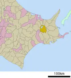 Location of Teshikaga in Hokkaido (Kushiro Subprefecture) | |
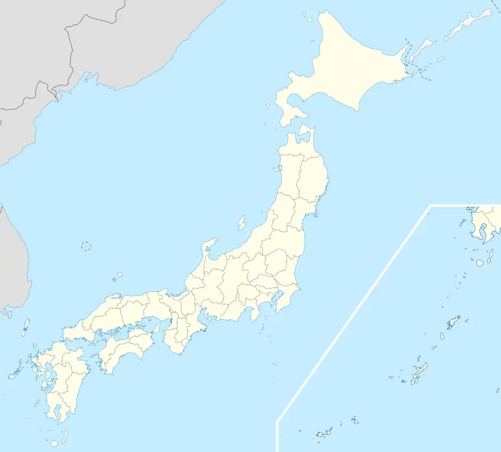 Teshikaga Location in Japan | |
| Coordinates: 43°29′N 144°28′E / 43.483°N 144.467°E | |
| Country | Japan |
| Region | Hokkaido |
| Prefecture | Hokkaido (Kushiro Subprefecture) |
| District | Kawakami |
| Area | |
| • Total | 774.53 km2 (299.05 sq mi) |
| Population (September 30, 2016) | |
| • Total | 7,631 |
| • Density | 9.9/km2 (26/sq mi) |
| Time zone | UTC+09:00 (JST) |
| Climate | Dfb |
| Website | www |
Teshikaga (弟子屈町, Teshikaga-chō) is a town located in Kushiro Subprefecture, Hokkaido, Japan. In September 2016, it had an estimated population of 7,631 and an area of 774.53 km2.
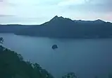
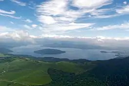
Tourist attractions in the town include Lake Mashū (Ainu: Kamuy-to), Lake Kussharo (Ainu: Kutcar or Kutcaro) and Kawayu Onsen.
History
- 1923: Teshikaga Village is formed.
- 1947: Teshikaga Village becomes Techikaga Town.
Climate
| Climate data for Teshikaga (1991−2020 normals, extremes 1977−present) | |||||||||||||
|---|---|---|---|---|---|---|---|---|---|---|---|---|---|
| Month | Jan | Feb | Mar | Apr | May | Jun | Jul | Aug | Sep | Oct | Nov | Dec | Year |
| Record high °C (°F) | 6.2 (43.2) |
7.6 (45.7) |
16.4 (61.5) |
27.5 (81.5) |
35.7 (96.3) |
33.7 (92.7) |
34.4 (93.9) |
34.4 (93.9) |
31.3 (88.3) |
24.7 (76.5) |
19.1 (66.4) |
12.9 (55.2) |
35.7 (96.3) |
| Average high °C (°F) | −3.1 (26.4) |
−2.7 (27.1) |
1.4 (34.5) |
8.2 (46.8) |
14.6 (58.3) |
17.8 (64.0) |
21.2 (70.2) |
22.4 (72.3) |
19.6 (67.3) |
14.1 (57.4) |
6.9 (44.4) |
−0.2 (31.6) |
10.0 (50.0) |
| Daily mean °C (°F) | −7.2 (19.0) |
−7.1 (19.2) |
−2.9 (26.8) |
2.8 (37.0) |
8.5 (47.3) |
12.5 (54.5) |
16.4 (61.5) |
17.9 (64.2) |
14.9 (58.8) |
8.9 (48.0) |
2.1 (35.8) |
−4.5 (23.9) |
5.2 (41.3) |
| Average low °C (°F) | −12.6 (9.3) |
−12.7 (9.1) |
−8.0 (17.6) |
−2.2 (28.0) |
3.1 (37.6) |
8.1 (46.6) |
12.7 (54.9) |
14.3 (57.7) |
10.6 (51.1) |
3.4 (38.1) |
−3.2 (26.2) |
−9.9 (14.2) |
0.3 (32.5) |
| Record low °C (°F) | −23.1 (−9.6) |
−26.7 (−16.1) |
−21.1 (−6.0) |
−14.7 (5.5) |
−5.3 (22.5) |
−0.9 (30.4) |
2.0 (35.6) |
5.6 (42.1) |
−1.0 (30.2) |
−8.0 (17.6) |
−16.3 (2.7) |
−21.4 (−6.5) |
−26.7 (−16.1) |
| Average precipitation mm (inches) | 50.6 (1.99) |
43.4 (1.71) |
64.5 (2.54) |
82.3 (3.24) |
99.9 (3.93) |
80.2 (3.16) |
106.2 (4.18) |
154.3 (6.07) |
154.1 (6.07) |
119.2 (4.69) |
71.6 (2.82) |
66.0 (2.60) |
1,092.3 (43.00) |
| Average precipitation days (≥ 1.0 mm) | 9.4 | 7.7 | 9.6 | 10.6 | 10.4 | 9.4 | 11.1 | 11.9 | 12.1 | 10.1 | 9.3 | 9.6 | 121.2 |
| Mean monthly sunshine hours | 134.2 | 139.7 | 163.6 | 157.7 | 162.7 | 133.2 | 108.4 | 115.6 | 131.3 | 150.7 | 134.4 | 132.9 | 1,664.4 |
| Source: Japan Meteorological Agency[1][2] | |||||||||||||
Notable people from Teshikaga
- Taiho Koki - sumo wrestler (born on Sakhalin but moved to Teshikaga aged 5)
- Kotogatake Koichi - sumo wrestler
Gallery
References
- ↑ 観測史上1~10位の値(年間を通じての値). JMA. Retrieved March 3, 2022.
- ↑ 気象庁 / 平年値(年・月ごとの値). JMA. Retrieved March 3, 2022.
External links
 Media related to Teshikaga, Hokkaidō at Wikimedia Commons
- Official Website (in Japanese)
| ||||||||||||
| ||||||||||||
| ||||||||||||
| ||||||||||||
| ||||||||||||
| ||||||||||||
| ||||||||||||
| ||||||||||||
| ||||||||||||
| ||||||||||||
| ||||||||||||
| ||||||||||||
| ||||||||||||
| ||||||||||||
This article is issued from Wikipedia. The text is licensed under Creative Commons - Attribution - Sharealike. Additional terms may apply for the media files.