Shahritus District
| |
|---|---|
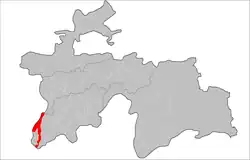 Location of the district in Tajikistan | |
| Coordinates: 37°19′N 68°06′E / 37.317°N 68.100°E | |
| Country | |
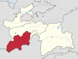
| Region | Khatlon Region |
| Capital | Shahritus |
| Area | |
| • Total | 1,500 km2 (600 sq mi) |
| Population (2020) | |
| • Total | 130,000 |
| • Density | 87/km2 (220/sq mi) |
| Time zone | UTC+5 |
| Official languages | |
| Website | shahrituz |
Shahritus District or Nohiya-i Shahritus (Tajik: Ноҳияи Шаҳритӯс) is a district in Khatlon Region, southwestern Tajikistan. Its capital is the town Shahrituz. The population of the district is 130,000 (January 2020 estimate).[2]
Administrative divisions
The district has an area of about 1,500 km2 (600 sq mi) and is divided administratively into one town and five jamoats.[3] They are as follows:[4]
| Jamoat | Population (Jan. 2015)[4] |
|---|---|
| Shahritus (town) | 15,800[5] |
| Kholmatov | 31,654 |
| Jura Nazarov | 17,808 |
| Obshoron | 8,648 |
| Pakhtaobod | 21,270 |
| Sayyod | 15,858 |
References
- ↑ "КОНСТИТУЦИЯ РЕСПУБЛИКИ ТАДЖИКИСТАН". prokuratura.tj. Parliament of Tajikistan. Retrieved 9 January 2020.
- ↑ "Population of the Republic of Tajikistan as of 1 January 2020" (PDF) (in Russian). Statistics office of Tajikistan. Retrieved 9 October 2020.
- ↑ "Regions of the Republic of Tajikistan 2017" (PDF) (in Russian). Statistics office of Tajikistan. pp. 15–21. Retrieved 12 October 2020.
- 1 2 Jamoat-level basic indicators, United Nations Development Programme in Tajikistan, accessed 9 October 2020
- ↑ "Population of the Republic of Tajikistan as of 1 January 2015" (PDF) (in Russian). Statistics office of Tajikistan. Archived from the original (PDF) on 2 July 2015.
Capital: Bokhtar | |||||||||||||||||||||||||||||||||||||||||||||||
|  | ||||||||||||||||||||||||||||||||||||||||||||||
|
| |||||||||||||||||||||||||||||||||||||||||||||||
| |||||||||||||||||||||||||||||||||||||||||||||||
This article is issued from Wikipedia. The text is licensed under Creative Commons - Attribution - Sharealike. Additional terms may apply for the media files.