Michigan Highways
The State Trunkline Highway System of the US state of Michigan is a network of roads owned and maintained by the Michigan Department of Transportation (MDOT). The most prominent of these roads are part of one of three numbered highway systems in Michigan: Interstates Highways, US Highways, and the other State Trunklines. Other systems of roads are operated by the 83 counties in the state as well as each city.
Interstate Highways and US Highways are assigned at the national level. Interstate Highways are numbered in a grid—even-numbered highways are east–west highways (with the lowest numbers along Mexico and the Gulf of Mexico), and odd-numbered highways are north–south highways (with the lowest numbers along the Pacific Ocean). US Highways are also numbered in a grid—even numbered for east–west highways (with the lowest numbers along Canada) and odd numbered for north–south highways (with the lowest numbers along the Atlantic Ocean). For this reason, mainline (two-digit) Interstate Highways in Michigan all have numbers above 69 and mainline US Highways all have numbers below 45. Three-digit Interstate and U.S. Highways, also known as "child routes," are branches off their main one- or two-digit "parents". The Interstate and US Highways are maintained by MDOT. Interstate 75 (I-75) and US Highway 23 (US 23) are the longest examples in the state.
State Trunklines are the other state highways maintained by MDOT. These highways are completely owned and maintained by the state. Michigan highways are properly referred to using the M and never as "Route 28" or "Highway 115", but as M-28 or M-115. The marker used for state trunklines is a diamond with a block-letter "M" at the top. Roads that are maintained by the state but not assigned a state trunkline designation carry an unsigned highway designation.
County-Designated Highways are assigned numbers in a zone system by MDOT, but maintained by the counties. Each zone is indicated by a letter A–H which is followed by a number based on a grid inside that zone. Each county also maintains any other roadway that is not a state trunkline or a city street. The numbering and signing practices vary from county to county, as does the size of each county's system. Numerical designations typically do not carry over from one county to the next; a CDH that crosses county lines keeps its designation in each county however. County road designations are typically abbreviated "CR" or "Co Rd" followed by the number, and CDHs are abbreviated to just their letter and number assignment.
 Recognized content -
US Highway 16 (US 16), also called Grand River Avenue for much of its length in the state, was one of the principal roads prior to the post-World War II construction of freeways in the state of Michigan. Before the creation of the United States Numbered Highway System in 1926, the highway had been designated as a state highway numbered M-16. The modern route of Grand River Avenue cuts across the Lower Peninsula in a northwest–southeast fashion from near Grand Rapids to Detroit. Before the late 1950s and early 1960s, US 16 followed other roads between Muskegon and Grand Rapids, and then Grand River Avenue through Lansing to Detroit. In the years immediately preceding the creation of the Interstate Highway System, US 16 was shifted from older roads to newer freeways. Later, it was co-designated as an Interstate. When the gap in the freeway was filled in around Lansing, the US 16 designation was decommissioned in the state. The freeway was solely designated Interstate 96 (I-96) east of Grand Rapids and I-196 west of that city.
The original pathway along the Grand River Avenue corridor was an Indian trail, a footpath used by the native population. The first European settlers to the area now known as Michigan also used this trail and in some areas enlarged it for the passage of wagons. In Detroit, Grand River is one of five major avenues (along with Woodward, Michigan, Gratiot, and Jefferson) planned by Judge Augustus Woodward in 1805 that extended from Downtown Detroit in differing radial directions; Grand River Avenue extends northwesterly from the city's downtown. In the middle of the 19th century, the trail was expanded into a plank road that formed the basis for one of the first state trunkline highways as M-16 in the early 20th century. Later, the highway was rerouted to replace M-126 and create M-104. Current segments of the roadway are still part of the state highway system as sections of M-5, M-11, M-43 or business loops off I-96. The portion of Grand River Avenue in Detroit between I-96 and the intersection with Cass Avenue and Middle Street in Downtown Detroit is an unsigned state trunkline, sometimes referred to as Old Business Spur I-96 (Old BS I-96). (Full article...)General images
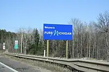 Welcome sign along US 8
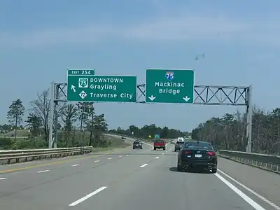 Exit 254 on I-75 south of Grayling
 Interstate HighwaysOther freewaysMiscellaneous expressways
 M-121 in Jenison
.jpg.webp) M-87 on November 1, 1956
M-87 on November 1, 1956 Grand River Avenue, once a part of M-16 and later US 16, was originally an Indian trail converted as a plank road before becoming a state highway.
 H-58 west of Grand Marais
 Planning map for the Detroit area freeways from 1955
 M-39 bridge over the River Rouge in Dearborn
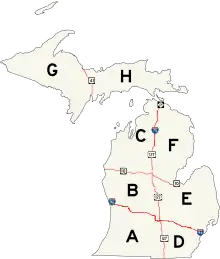 Map of the zone system
 Dead Man's Curve along the Marquette–Negaunee Road shown in 1917 with its hand-painted centerline, the first in the nation
 H-13 during winter
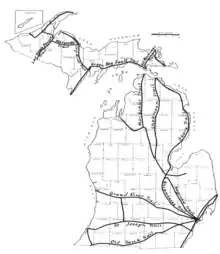 Map of the pre-statehood Indian trails
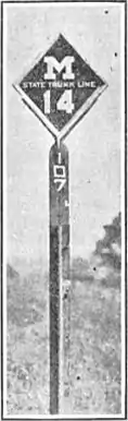 Milemarker used in 1922 for M-14
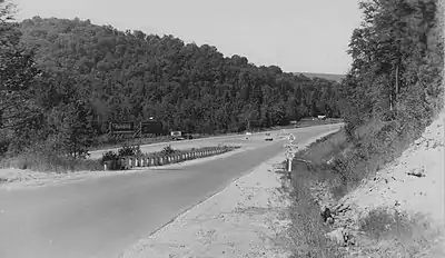 Junction between M-28 and M-178 south of Munising before 1941
 M-553 approaching Glass' Curve south of Marquette
 Construction along I-96 for the interchange with M-231 in July 2013 (from Michigan State Trunkline Highway System)
.JPG.webp) A-2 in Allegan County south of Holland
A-2 in Allegan County south of Holland
Selected picture
.jpg.webp)
Topics
State Trunkline System, overview of the system
- Interstates Highways in the state
- US Highways in the state
- State Trunklines
- County-Designated Highways in the state
- Pure Michigan Byways, a system of scenic, historical or recreational highways in the state
- Great Lakes Circle Tour
Subcategories
Related portals
WikiProjects
![]()
- U.S. Roads WikiProject
- Michigan State Highways Task Force
- Michigan WikiProject
- Detroit Task Force
Things to do
Nominations and votes for selected articles and selected pictures are always needed. Anyone can nominate an article, and anyone can vote for an article. You can also recommend items for Did you know?. Improvements to the articles are always welcome as the project works on expanding and nominating the remaining ones for Good Article or Featured Article status.
-
 List of all portalsList of all portals
 -
 The arts portal
 -
 Biography portal
 -
 Current events portal
 -
 Geography portal
 -
 History portal
 -
 Mathematics portal
 -
 Science portal
 -
 Society portal
 -
 Technology portal
 -
 Random portalRandom portal
 -
 WikiProject PortalsWikiProject Portals