Tell Rifaat Subdistrict
ناحية تل رفعت | |
|---|---|
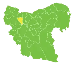 Location of Tell Rifaat Subdistrict within Aleppo Governorate | |
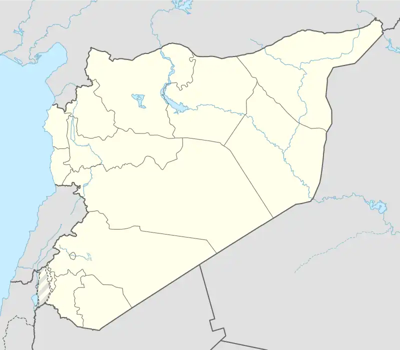 Tell Rifaat Subdistrict Location in Syria | |
| Coordinates (Tell Rifaat): 36°27′15″N 37°06′00″E / 36.45406°N 37.09992°E | |
| Country | |
| Governorate | Aleppo |
| District | Azaz District |
| Seat | Tell Rifaat |
| Area | |
| • Total | 204.52 km2 (78.97 sq mi) |
| Population (2004)[1] | 43,781 |
| Geocode | SY020402 |
Tell Rifaat Subdistrict (Arabic: ناحية تل رفعت, romanized: Nāḥiyah Tel Rif'at) is a subdistrict of Azaz District in northwestern Aleppo Governorate of northern Syria. Administrative centre is the town of Tell Rifaat.
At the 2004 census, the subdistrict had a population of 43,781.[1]
Cities, towns and villages
| PCode | Name | Population |
|---|---|---|
| C1621 | Tell Rifaat | 20,514 |
| C1626 | Kafr Naya | 5,647 |
| C1624 | Shaykh Issa | 4,296 |
| C1620 | Deir Jamal | 4,287 |
| C1623 | Ahras | 2,851 |
| C1617 | Tell Jabin | 2,579 |
| C1628 | Kafr Naseh | 1,433 |
| C1618 | Tellejar | 858 |
| C1619 | Tanib | 708 |
| — | al-Jihad | 237 |
| C1627 | Masqan | 222 |
| C1622 | Tatemrash | 111 |
| C1625 | Kashtaar | 38 |
References
- 1 2 "2004 Census Data for Nahiya Tell Rifaat" (in Arabic). Syrian Central Bureau of Statistics. Retrieved 15 October 2015. Also available in English: UN OCHA. "2004 Census Data". Humanitarian Data Exchange. Archived from the original on 8 December 2015. Retrieved 4 December 2015.
Capital: Aleppo | ||||||||||||||||||||
|   | |||||||||||||||||||
|
| ||||||||||||||||||||
| ||||||||||||||||||||
| ||||||||||||||||||||
| ||||||||||||||||||||
| ||||||||||||||||||||
| ||||||||||||||||||||
| ||||||||||||||||||||
| ||||||||||||||||||||
This article is issued from Wikipedia. The text is licensed under Creative Commons - Attribution - Sharealike. Additional terms may apply for the media files.